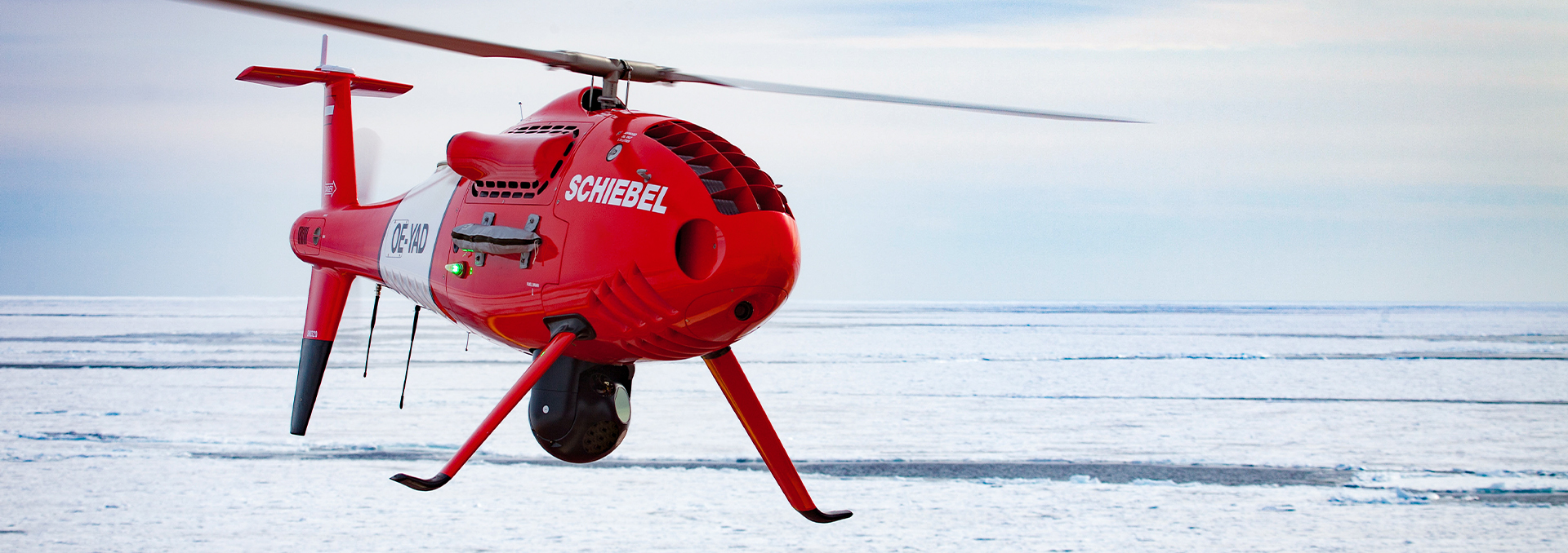


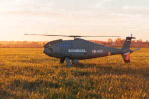

CAMCOPTER S-100 VTOL UAS
Product descripton: CAMCOPTER S-100 VTOL UAS by Schiebel Group
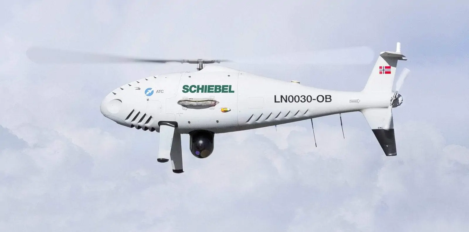
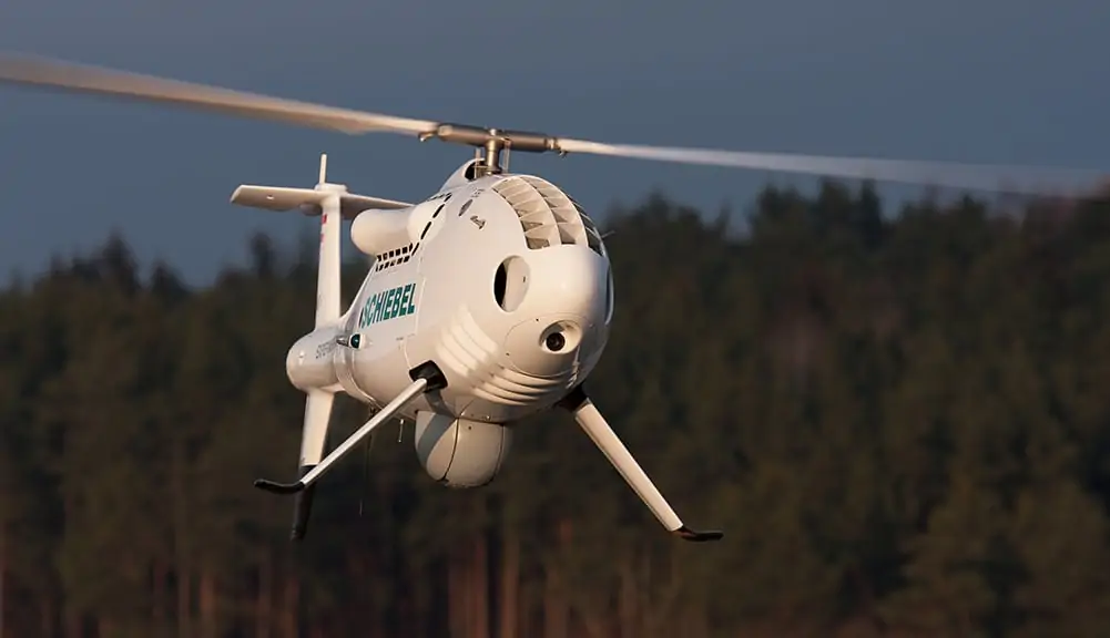
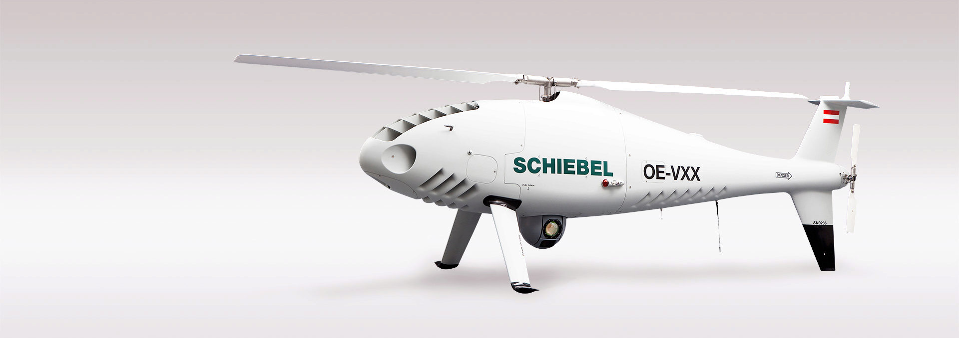
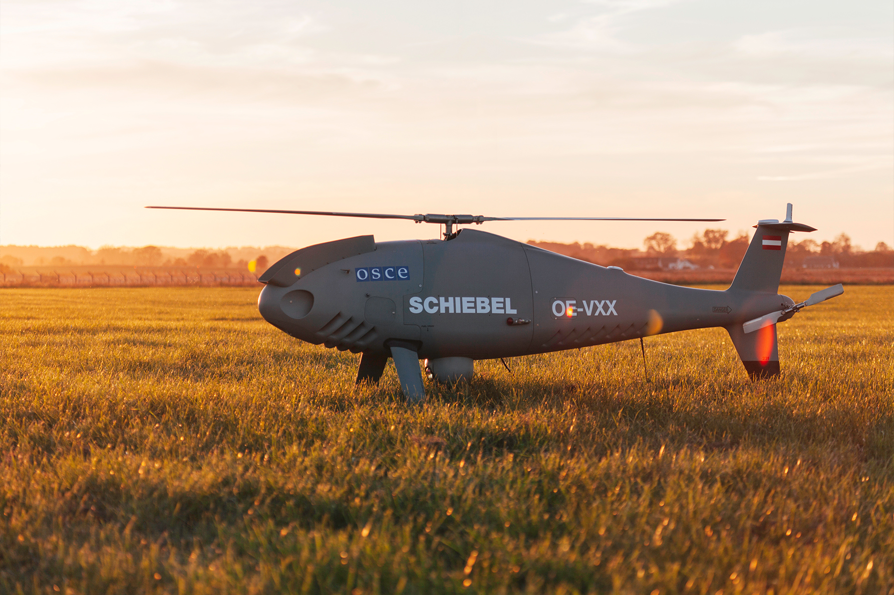
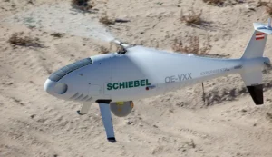
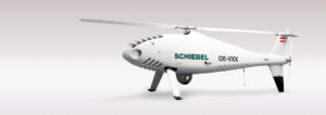
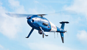
Schiebel’s CAMCOPTER® S-100 Unmanned Air System (UAS) is a proven capability for military and civilian applications. The Vertical Takeoff and Landing (VTOL) UAS needs no prepared area or supporting launch or recovery equipment. It operates day and night, under adverse weather conditions, with a range out to 200 km, both on land and at sea. The S-100 navigates automatically via pre-programmed GPS waypoints or can be operated directly with a pilot control unit. Missions are planned and controlled via a simple point-and-click graphical user interface. High-definition payload imagery is transmitted to the control station in real time. Using “fly-by-wire” technology controlled by redundant flight computers, the UAV can complete its mission automatically in the most complex of electromagnetic environments. Its carbon fiber and titanium fuselage provides capacity for a wide range of payload / endurance combinations.
Civil Applications
-
Land-Based Operations: Inspect power lines, collect atmospheric or CBR samples, perform LIDAR mapping, and survey forests, agriculture, or urban areas.
-
Aerial Cinematography: Stable platform for high-definition cameras, allowing precise maneuvers and minimal operational footprint in sensitive environments.
-
Airborne Laser Scanning: High-accuracy, rapid mapping for resource exploration, planning, and geospatial data collection.
Military Applications
-
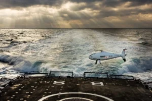
Maritime Operations: Extends naval situational awareness, supports long-range reconnaissance, and enhances operational responsiveness.
-
Multi-Sensor Surveillance: Can carry multiple sensors simultaneously (EO, radar, ESM), improving maritime domain awareness.
-
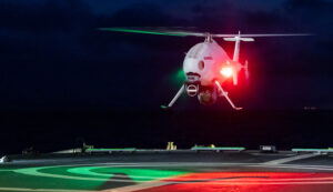
All-Oceans Deployment: Proven shipboard capability with automated takeoff/landing, operable in winds up to 25 knots and sea states >3.
-
Long-Range Reconnaissance: Real-time reconnaissance up to 200 km with integration to command and control systems.
Key Features
-
Multi-sensor payload capability
-
Automated shipboard landing system
-
High navigational accuracy
-
Long endurance and VTOL capability
Technical specifications
The CAMCOPTER® S-100 offers proven, reliable performance, long operational ranges, accurate navigation and high-data-rate communications capabilities.
Performance Specifications
| Dash speed | 100 kn (185 km/h) IAS |
| Loiter speed | 55 kn IAS (102 km/h) for maximum endurance |
| Endurance | >6 h with 34 kg (75 lbs) payload plus optional external fuel tank extending endurance to >10 h |
| Service ceiling | 18000 ft in ISA conditions @ reduced GW |
| Airframe loading | +3.5 g to -1 g rated |
| Operating temperature | -40°C to +55°C (-40°F to +131°F) |
| Wind (takeoff and landing) | Up to 25 kn (46 km/h) |
Technical Specifications
| Main rotor diameter | 3400 mm (133.9”) |
| Total length | 3110 mm (122”) |
| Total height | 1120 mm (44”) |
| MTO weight | 200 kg (440 lbs) |
| Typical empty weight | 114 kg (251 lbs) |
| Payload capacity | 50 kg (110 lbs) |
| Fuel (internal tanks) | 57 l (15.0 gal) AVGAS 100LL, JP-5 (NATO F-44), Jet A-1 (NATO F-35) |
| Payload electrical power | 1000 W |
| Data link range | Up to 200 km (108 nm) available |
Payloads
The CAMCOPTER® S‑100 features platform and payload growth capabilities – with two payload bays, an auxiliary electronics bay, as well as two side payload hard points and the ability to carry underslung loads. The maximum payload weight is 50 kg (110 lbs).
The S‑100 is able to carry multiple sensors, enabling customers to:
-
gather images with an EO/IR camera
-
detect and identify electronic signatures with ESM systems
-
use SAR radar simultaneously in real time with only one system.
Payload types:
-
EO/IR
-
Radar
-
Lidar
-
Sigint
-
Hyperspectral
-
Others
Electro‑Optical/Infrared (EO/IR) gimbals provide advanced wide‑area situational awareness and intelligence gathering.
Synthetic Aperture Radar (SAR) supports high‑resolution all‑weather ground mapping and moving target indication.
Laser Imaging Detection and Ranging (LIDAR) measures distance using laser reflectance and supports 3D geographic survey.
Signals intelligence (SIGINT) gathers communication and electronic signals.
Hyperspectral imaging collects and processes data across the spectrum for mapping and mineral analysis.
| Payload Location | Max. Payload Weight |
|---|---|
| Nose payload bay | 10 kg (22 lbs) |
| Side payloads | 10 kg (22 lbs) on each side |
| Main payload bay | 50 kg (110 lbs) |
| Auxiliary payload bay | 10 kg (22 lbs) |
Operational Options Text
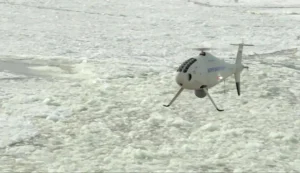
The S‑100 has been widely deployed globally in environments from the Arctic to deserts, aided by its minimal logistics footprint and quick deployment capability.
Operational options and features:
-
Stationary Deployment
-
Control station space: 6060 mm x 2440 mm (239″ x 96″)
-
Quick setup time: 3 h
-
Operated by 2 persons
-
Operable from a 20′ container
-
-
Mobile Deployment
-
Unlimited flexibility
-
Simple vehicle integration
-
Flexible C2 integration
-
Operation from urban and austere sites
-
-
Maritime Operations
-
Detection, tracking, identification of maritime objects
-
360‑degree coverage
-
Accurate geo‑location
-
Two‑man operation with a small logistics footprint
-
Proven on various ships
-
Simple ship integration, no specialized infrastructure needed
-
NATO‑standard harpoon option
-
-
Network Capabilities
-
Encrypted data link with range up to 200 km
-
GPS for high‑accuracy navigation with optional anti‑jamming
-
Dual‑redundant Inertial Navigation Systems (INS)
-
Integration with customer networks
-
Environmental performance:
-
Operation possible in harsh conditions, high sea states, strong cross‑deck winds.