


UniVTOL V2200
Product descripton: UniVTOL V2200 by The Bionic Eye
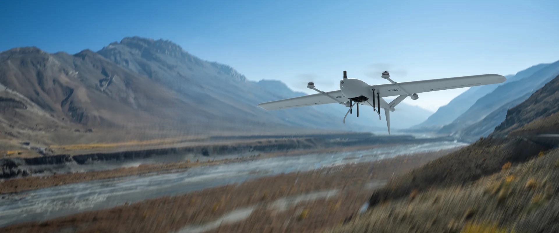
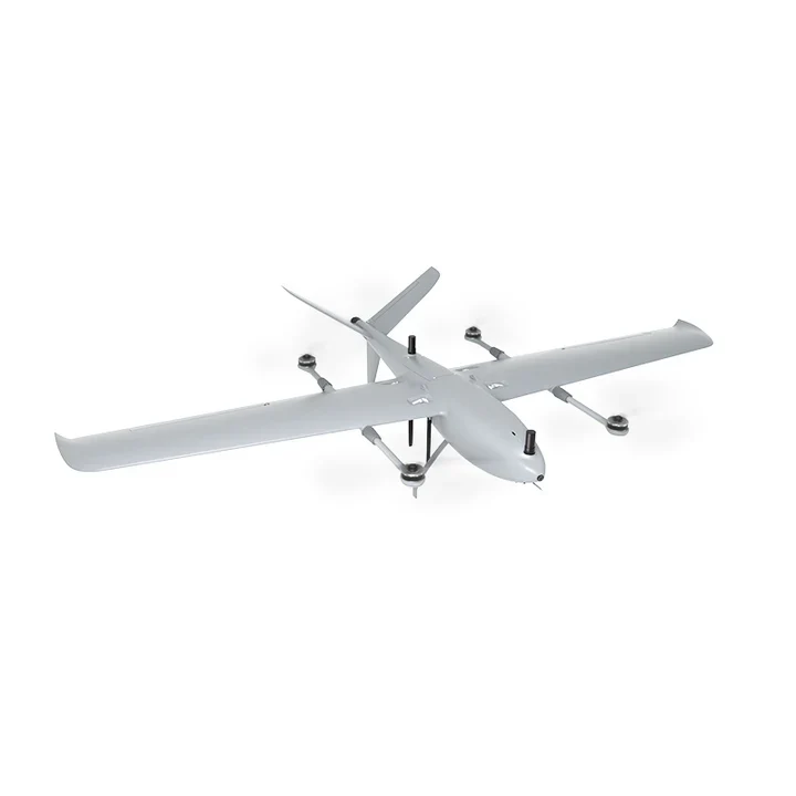
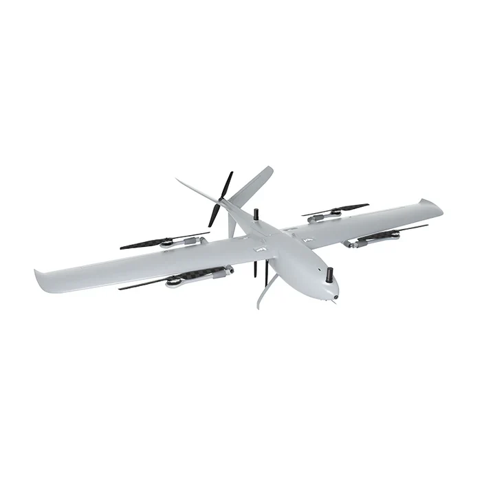
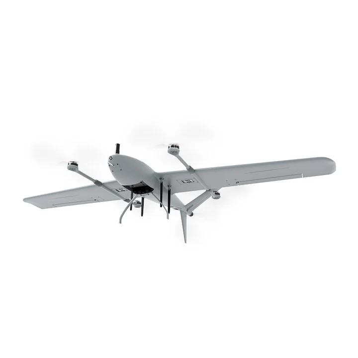
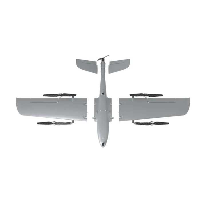
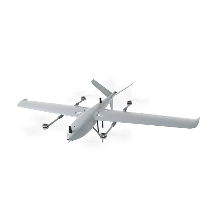
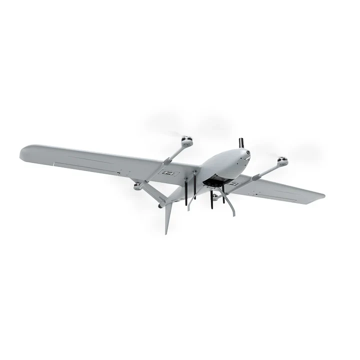
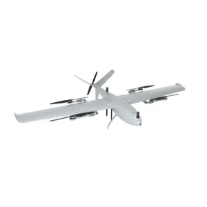
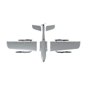
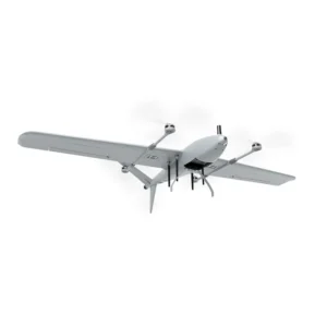
The Reebot Robotics UniVTOL V2200 Drone Platform is an advanced industrial-grade VTOL fixed-wing drone, engineered for high-endurance aerial missions such as mapping, surveying, industrial inspections, and surveillance. This multipurpose UAV integrates cutting-edge aerodynamics, intelligent AI capabilities, and centimeter-level RTK positioning, making it an optimal choice for enterprises requiring precision, efficiency, and long-range data acquisition.
With a 125-minute max flight time, 40 km transmission range, and highly modular design, the UniVTOL V2200 is designed to enhance operational productivity, adaptability, and ease of deployment. It supports multiple payload configurations, including orthophoto cameras, optical pods, and multispectral sensors, allowing professionals to conduct large-scale terrain mapping, infrastructure monitoring, and remote sensing detection with high precision.
Why Choose the UniVTOL V2200?
1. Superior Flight Performance & Versatility
Designed for long-range and high-precision missions, the UniVTOL V2200 delivers exceptional endurance and payload capacity for professional-grade surveying, mapping, and surveillance applications.
2. Rapid Deployment & Ease of Use
With a screw-free quick-release design, the UniVTOL V2200 allows for fast assembly and disassembly, reducing operational downtime and ensuring rapid deployment in the field.
3. Advanced AI & Smart Navigation
Equipped with optional AI tracking and intelligent flight planning, the drone can autonomously recognize and track objects, improve operational efficiency, and enhance safety in complex environments.
4. High-Precision Data Acquisition
The dual-antenna RTK GNSS positioning system ensures centimeter-level accuracy, making it an ideal choice for professional surveying, mapping, and industrial inspections.
5. Adaptability Across Industries
The UniVTOL V2200 is highly adaptable, supporting multiple payloads for terrain mapping, infrastructure inspection, security monitoring, and environmental analysis.
Technical specifications
| Parameter | Specification |
|---|---|
| Aircraft Weight (without battery) | 5.1 kg |
| Maximum Take-Off Weight (MTOW) | 8.4 kg |
| Maximum Payload Capacity | 1 kg |
| Flight Time (no payload) | Up to 125 minutes |
| Flight Time (full load) | Up to 114 minutes |
| Flight Time (with ZT30 Optical Pod) | Up to 90 minutes |
| Cruise Speed | 18 m/s |
| Maximum Airspeed | 25 m/s |
| Hovering Radius | 200 m |
| Transmission Range | Up to 40 km (dual-frequency redundancy) |
| Wind Resistance | Level 4 (multirotor mode), Level 5 (fixed-wing mode) |
| Navigation Precision | Centimeter-level (dual-antenna RTK GNSS) |
| VTOL Capability | Vertical takeoff and landing (no runway required) |
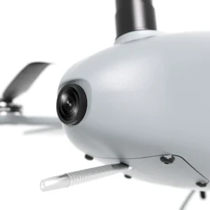
| FPV Camera | 4K ultra-wide, 113° HFOV / 122° VFOV |
| Flight Control System | Open-source (ArduPilot compatible) |
| Ground Control Software | UniGCS, QGroundControl, Mission Planner |
| Ground Control Station | UniRC7 Pro, Android 13, 7-inch 1600-nit display |
| AI Capabilities | Optional AI object recognition & tracking (SIYI AI Tracking Module II) |
| IP Protection Rating | IP53 |
| Wingspan | 2200 mm |
| Dimensions (L × W × H) | 2200 × 1280 × 460 mm |
| Packing Dimensions | 1400 × 630 × 540 mm |
| Packing Type | Aviation aluminum case |
| Assembly Time | < 1 minute (screw-free, quick-release design) |