


Evo Government
Product descripton: Evo Government by DeltaQuad
Aerial Intelligence
Double down on performance with dual payload capacity and extended flight range
Key Performance
-
4.5 hours flight time
-
272 km range
-
3 kg payload
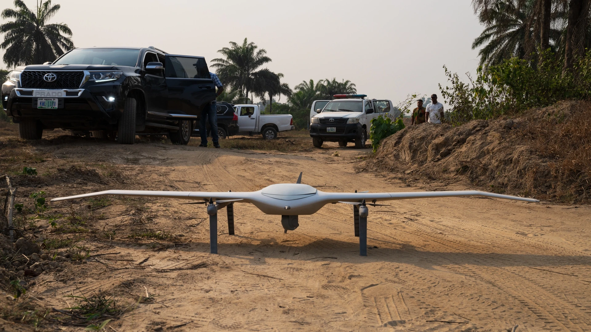
Vertical Takeoff and Landing
Evo takes off and lands vertically in confined spaces. Automatic landing gear provides 360° free field of view throughout mission execution.
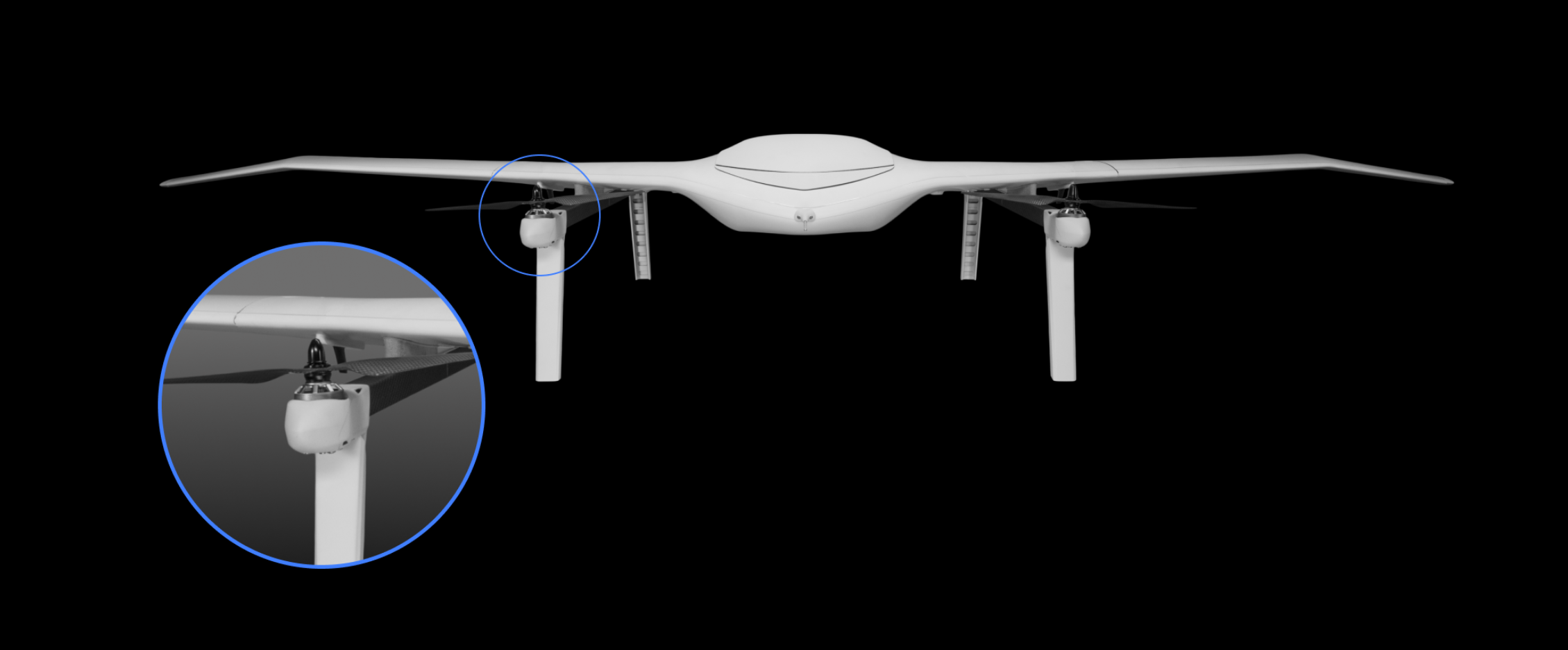
Dual Swappable Payloads
Operate two sensors simultaneously or extend flight time with an auxiliary battery. Modular payload system enables maximum insight and rapid field adaptation for a vast range of sensors, automation, or customization options.
Extreme Efficiency
Patented wing design and aerodynamic performance deliver over twice the range and endurance of comparable government drone systems, dramatically extending operational capabilities.
User-Serviceable Design
Evo’s modular architecture enables rapid field maintenance and capability upgrades, maximizing operational readiness without factory servicing.
A New Dimension to Governmental Intelligence
Evo Government offers advanced UAV technology to support public safety.
ATAK Compatible
Integrates ATAK standards for mesh collaboration with a vast range of military-grade government drone systems for insight and data sharing.
Fully Integrated
All Evo capabilities and payload systems are accessible through a single, integrated interface, reducing training requirements and improving mission execution.
Future-Proof
Modular design and dual swappable payloads enable cost-effective capability expansion for quick integration of new search and rescue drone technologies.
Technical specifications
| Parameter | Specification |
|---|---|
| Maximum Flight Time | 255 minutes |
| Maximum Flight Range | 254 km / 158 mi |
| Maximum Radio Range | 80 km |
| Ground Control Station | Panasonic Toughbook |
| Radio Options | Silvus 2.2–2.5 GHz |
| GNSS System | L1/L2 GPS |
| ATAK Compatibility | Yes |
| Automatic Dependent Surveillance Software | No |
| Stealth Switch | No |
| Interference Avoidance | No |
| Inertial Navigation | Automatic return-to-home |
Engineered for Advanced Surveillance and Monitoring
Top-of-the-line transmission and control options to help public service organizations use aerial intelligence in their decision-making.
Environmental Resilience
-
IP54 ingress protection
-
-20°C to 45°C temperature tolerance
-
27 knots wind tolerance
Ruggedized Control with Extended Range
Equipped with a MIL-STD toughbook GCS and familiar joystick controller, Evo Government offers various radio and data link options. Standardized on the battlefield-proven and EW-resistant Silvus Streamcaster data link.
-
80 km Automatic Tracker
-
40 km Sector Antenna
-
15 km Omni Directional
Elevated ISR Abilities
Evo Government is capable of autonomous target tracking, automatic following, 720p onboard recording, precise target positioning, video-based click and navigate, and Cursor on Target integration, up to 80 km range for single and dual search and rescue drone operators.
-
HD recording
-
80× zoom
-
Thermal vision
Master Precision Mapping
Integrate RGB, Multispectral, LiDAR, and IR data to generate instant, high-precision geo-referenced maps. Leverage cutting-edge NTRIP RTK corrections for real-time accuracy, with PPK post-processing capabilities.
-
3200+ ha coverage at 3 cm/px
-
61 MP RGB mapping
-
0.6 cm/px maximum resolution
Visualize Terrain Profiles
Transform raw data into actionable intelligence. Capture detailed LiDAR scans and high-resolution RGB imagery in a single flight. Generate colorized 3D point clouds to reveal intricate terrain profiles.
-
1200 ha coverage
-
20 MP rolling shutter
-
8 MP global shutter
Customizable at Its Core
Custom single or dual payload flexibility. 3D models and access to onboard computing included along with all the I/O optionality you will need in a government drone.
-
5V & 16V power
-
MAVLink vehicle control
-
2.5 kg customization payloads