Using AI-Enabled Drones for Border Security: Key Considerations
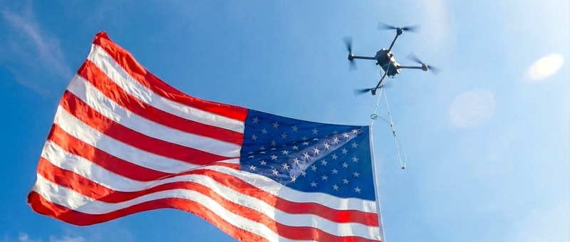
Patrolling, land surveying, topography mapping, search and rescue missions — drones have become a staple tool for the AI border security forces. The EU border agency Frontex deployed drones successfully in Greece and Malta to monitor illegal migration. In 2023, the agency spent another €144 million on new drone purchases to support wider deployments. The US Department of Homeland Security also purchased over $1.8 million of drones for border patrolling last year.
Compact, cost-effective, and easily deployable, drones are also becoming more sophisticated, featuring pre-trained AI models for navigation, object detection, and land surveying.
AI Border Security: Combining Drones and AI
Drones offer many advantages to AI border security patrol — rapid coverage of wider areas, more effective maritime monitoring, and greater cost-efficiency compared to deploying helicopter flights. The new generation of AI-powered drones is also capable of supporting even more advanced security and surveying use cases.
Navigation in GPS-Denied Environments
Border patrolling drones are an effective deterrent to criminals contemplating smuggling operations or illegal border crossings. On the downside, drones are prone to signal jamming. Anti-drone guns can be purchased for several hundred dollars online, often without any ID required. Criminals are often taking advantage of that. Jamming is also a major issue during military conflicts or security training operations conducted in hostile environments.
US manufacturer Bavovna developed an AI-powered navigation system, for effectively operating in GPS-denied environments. The system combines modular hardware and AI technology to deliver precise and dependable navigation even in GPS-denied environments amidst aggressive electronic warfare scenarios.
By combining ES capabilities with Sensor Fusion AI navigation, Bavovna’s solution ensures dependable drone operations even under heavy signal interference, jamming, and meaconing. Pre-trained on real flight logs in GNSS-enabled and denied environments, the onboard AI system can navigate the drone along the pre-programmed flight plan using real-time sensor fusion. During recent field tests featuring a Radiobird Defender VTOL, Babovna’s AI navigation system helped pilot over 18 miles (30 km) of complex positioning without GNSS connectivity with an end-point positioning error of 0.42 – 0.63%.
Moreover, Bavovna recently presented a new EW-resilient, low-SWAP signal intelligence (SIGINT) capture solution. The drone-mounted system can detect the location of radio-emitted sources in a range from 500MHz to 12GHz during a fully autonomous flight, even in GPS-denied environments. The system can provide coastal guards with greater situational awareness, enabling the detection of communication between the mainland and unauthorized boat traffic.
Automated Patrolling and Intruder Detection
The latest drones performing AI border security functions are equipped with advanced computer vision systems and thermal cameras for a better object, vehicle, and human detection, even in poor lighting conditions. The pre-trained computer vision algorithms can detect heat signatures of people with high accuracy, enabling faster response from security forces.
For example, the Skydio X10 drone is pre-trained to detect and auto-follow people, vehicles, and other objects, allowing border officers to concentrate their attention in the right areas. Skydio NightSense algorithm also helps navigate drones more effectively in low and no-light conditions. Onboard sensors, paired with AI navigation algorithms, also support automatic obstacle detection and collision prevention. The algorithm also automatically reduces obstacle avoidance margins when piloting through narrow spaces — a handy feature for running environment scans indoors.
Land Surveying and Mapping
Drones as AI border security also help border forces collect geospatial data to map the border terrain better and inspect the current infrastructure in place (if any) for a fraction of the cost of chartered flights.
Details scans help determine new reinforcement areas, close gaps, and ensure all protective infrastructure is in good shape without conducting on-foot inspections.
Anafi AI from Parrot has a survey-grade accuracy of 0.46cm/px GSD at 100ft (30m), thanks to a 48 MP 1/2” CMOS sensor. Developed primarily for photogrammetry, Anafi AI includes several AI-assisted flight modes for creating (and flying) 3D asset scanning missions. During each flight, the AI technology continuously builds and updates an occupancy grid to ensure safer navigation. The algorithms also determine the best flight trajectory to avoid obstacles.
Using AI-powered drones responsibly in border operations
Although drones can substantially increase border safety, their usage also raises some rightful concerns about privacy.
The technology can be abused by law enforcement and used outside the authorized areas.
A 2020 NGO investigation found that US border patrol drones were found flying miles away from the country’s borders. In February-March 2020, one border patrol UAV conducted 20 flights in Panama’s airspace. Countless occasions of border patrol drones hoovering miles away from the designated border areas have also been recorded.
Such detours are problematic as they may be breaching unknowing citizens’ privacy. Border guards have also been found to use drones to collect and share non-immigration-related data with law enforcement in border communities, according to the flight logs.
AI-enabled drones must be used responsibly within authorized areas only and for a select number of approved use cases. Border forces must also maintain transparent records about the type of data being collected and how it’s being stored and used. Doing so is essential to protect the citizens’ rights to privacy.