CHC Navigation company
GNSS positioning solutions, UAV LiDAR mapping systems, and autonomous surface vessels delivering accurate geospatial intelligence and survey data.
CHC Navigation overview
CHC Navigation (CHCNAV) is a global technology company dedicated to advancing intelligent mapping, navigation, and positioning solutions for modern industries. We design technologies that empower professionals to operate with greater accuracy, efficiency, and confidence — from geospatial surveying and digital construction to robotics, autonomous systems, agriculture, and smart infrastructure.
Our products combine high-precision performance with accessible innovation, enabling organizations around the world to improve decision-making, optimize workflows, and unlock new value in their daily operations.
A Global Leader in Navigation and Geospatial Innovation
CHCNAV is recognized as one of the most comprehensive solution providers in the mapping, positioning, and navigation ecosystem. By integrating GNSS, LiDAR, UAV, INS, and machine automation technologies, we deliver end-to-end solutions that redefine industry standards for precision and reliability.
With a presence in over 130 countries, supported by a workforce of 1,900+ employees, we remain close to our customers through a strong global network. This proximity helps us understand rapidly evolving industry needs and ensure that our systems adapt to real-world challenges across different environments, industries, and regulatory landscapes.
Innovating Global Navigation & Mapping Solutions
Our mission is to make advanced geospatial and navigation technologies more accessible, scalable, and affordable without compromising accuracy or performance. We invest heavily in research and development — including positioning algorithms, LiDAR processing, GNSS+INS fusion, and cloud-based automation platforms — to deliver tools that are not only powerful but intuitive and future-ready.
We serve as a technology enabler for industries entering the next era of digital transformation. Whether supporting autonomous vehicles, large-scale mapping projects, smart agriculture, or advanced machine control, CHCNAV helps customers exceed expectations and achieve measurable results.

Core Business Segments
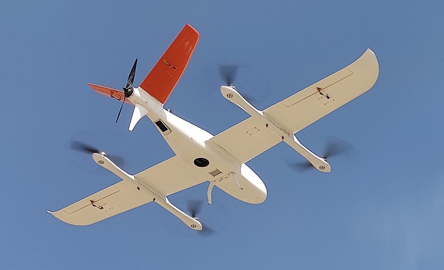
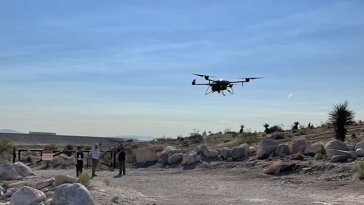
Geospatial — Advanced Mapping & Surveying Technologies
As a leader in the geospatial sector, CHCNAV delivers innovative tools that transform how professionals measure, capture, and analyze spatial data.
Our solutions integrate GNSS receivers, LiDAR systems, UAV platforms, and USV mapping vessels to deliver high-precision results across diverse terrains and environments.
From land survey and topographic mapping to urban digitalization and environmental monitoring, our geospatial technologies support smarter decisions and sustainable development worldwide.
Key strengths:
-
High-precision GNSS and RTK solutions
-
Aerial, terrestrial, and marine mapping systems
-
Integrated LiDAR and reality-capture workflows
-
End-to-end solutions for field and office coordination
Machine Control — Automating Heavy Equipment for Maximum Productivity
CHCNAV’s machine control portfolio enhances precision and efficiency across earthmoving, grading, and construction operations.
Our systems empower contractors and operators to maintain accuracy, stay on schedule, and reduce operational expenses across the job site.
Our offering includes:
-
GPS machine control systems for excavators, dozers, graders, and compactors
-
GNSS rovers and field-ready CAD workflows
-
Tools that improve productivity, reduce rework, and ensure projects stay within specification
By simplifying complex tasks and automating manual processes, our machine control technologies accelerate digital construction and enhance jobsite performance.
Navigation — Hybrid GNSS+INS Systems for Autonomy and Robotics
CHC Navigation is a global innovator in high-precision GNSS+INS navigation technologies designed for unmanned systems and robotics.
Our RTK sensors, navigation boards, and embedded chipsets provide centimeter-level accuracy, low-latency performance, and robust reliability in dynamic environments.
These solutions enable:
-
Autonomous vehicles
-
Robotics and smart mobility applications
-
UAV and UGV navigation
-
Industrial automation in mining, logistics, and construction
We provide scalable navigation platforms that integrators can adapt across multiple sectors, powering the next generation of autonomous solutions.
Agriculture — Smart Farming for Every Scale
CHCNAV develops affordable and intuitive agricultural technologies that help farmers enhance productivity while reducing costs and resource use.
Our precision agriculture solutions include auto-steering systems, tractor guidance tools, and GPS-driven workflows optimized for farms of all sizes.
Benefits include:
-
Improved planting accuracy
-
Optimized irrigation and spraying
-
Reduced fuel consumption and operational expense
-
Higher yields and sustainable agricultural practices
By integrating GNSS precision with easy-to-use automation tools, we empower farmers to modernize operations and achieve consistent long-term improvements.
Integrated Solutions for the World’s Most Demanding Workflows
One of CHCNAV’s defining strengths is its ability to deliver fully integrated, end-to-end solutions.
Our technologies span the entire ecosystem — from ground and airborne mapping to machine automation, real-time GNSS infrastructure, and cloud-based data services.
We unify data collection, processing, analysis, and navigation into a seamless workflow that reduces friction, increases reliability, and enhances output quality.
Integrated capabilities include:
-
GNSS surveying
-
3D mobile mapping
-
Airborne and USV mapping
-
Machine control systems
-
Agricultural auto-steering
-
GNSS augmentation services and corrections networks
This holistic approach allows professionals to navigate, measure, build, and manage with unmatched precision.
Driving the Future of Positioning Technology
Innovation as a Mission
At CHC Navigation, innovation is not just a value — it is the foundation of everything we do.
We invest significantly in research to develop:
-
Next-generation GNSS and multi-frequency positioning engines
-
Advanced LiDAR processing technologies
-
High-performance GNSS+INS navigation systems
-
Cloud platforms for automated workflows
-
Accessible solutions that deliver the strongest ROI on the market
Our commitment to quality and affordability has earned the trust of professionals across industries worldwide.
A Partner You Can Rely On
CHCNAV prides itself on building long-term relationships with customers, integrators, and distributors. We provide personalized support, tailored solutions, and responsive service through every stage of the customer journey.
Our global team ensures that wherever you work — whether in dense cities, remote fields, offshore environments, or high-risk industrial zones — you have access to technologies that elevate performance and create value.
Shaping a Smarter, More Connected Future
CHC Navigation is committed to advancing the world of mapping, navigation, and positioning through innovation, accessibility, and precision.
We empower industries to operate more efficiently, build more sustainably, and innovate more boldly.
With a comprehensive portfolio, a global presence, and a passion for technological progress, CHCNAV stands at the forefront of a rapidly transforming world — ready to support the next generation of digital, autonomous, and data-driven solutions.