DeltaQuad company
DeltaQuad is a pioneer in electric long-range VTOL UAVs, designing smart technology for mapping, inspection, and surveillance.
DeltaQuad overview
DeltaQuad is a pioneering UAV manufacturer based in the Netherlands, dedicated to designing and building advanced electric long-range VTOL aircraft. With a strong engineering culture and a commitment to reliability, the company has become a recognized name in the global unmanned aviation landscape. DeltaQuad’s systems are known for their user-friendly operation, robust performance, and adaptability across multiple industries — from defense and government missions to mapping, inspection, and environmental monitoring.
From the earliest prototypes to today’s advanced platforms, DeltaQuad has maintained a clear vision: to develop versatile UAVs that thrive in demanding environments and deliver dependable aerial intelligence. The company’s approach blends rigorous engineering, practical innovation, and a deep understanding of real-world operational needs. This long-term commitment has positioned DeltaQuad at the forefront of Europe’s UAV ecosystem.
Engineering Philosophy and Technology Mindset
At the heart of DeltaQuad’s identity is a strong focus on innovation that is both ambitious and grounded in practical application. The company continually improves its solutions through close collaboration with clients and by integrating new, proven technologies into its platforms. Instead of pursuing innovation for its own sake, DeltaQuad emphasizes scalable, realistic technological progress that directly enhances mission outcomes.
This philosophy influences everything from aerodynamics and energy efficiency to autonomy, payload integration, and field workflow. DeltaQuad UAVs are designed to operate with minimal pilot intervention, adapt quickly to new tasks, and deliver mission-critical results consistently. The aim is to provide tools that enhance user capability, not complicate operations — a mentality that has shaped the company’s reputation for ease of use and reliability.
A Mission Built Around Aerial Intelligence
DeltaQuad’s mission is to shape the future of aerial intelligence by developing UAVs that combine operational resilience, intelligent autonomy, and long-range capability. The company views unmanned aviation as a transformative force — one that can elevate situational awareness, streamline industrial workflows, and provide vital insights in both civilian and defense contexts.
Whether supporting decision-makers with real-time data or enabling organizations to operate safely at distance, DeltaQuad aircraft serve as essential assets for missions that depend on high-precision aerial information.
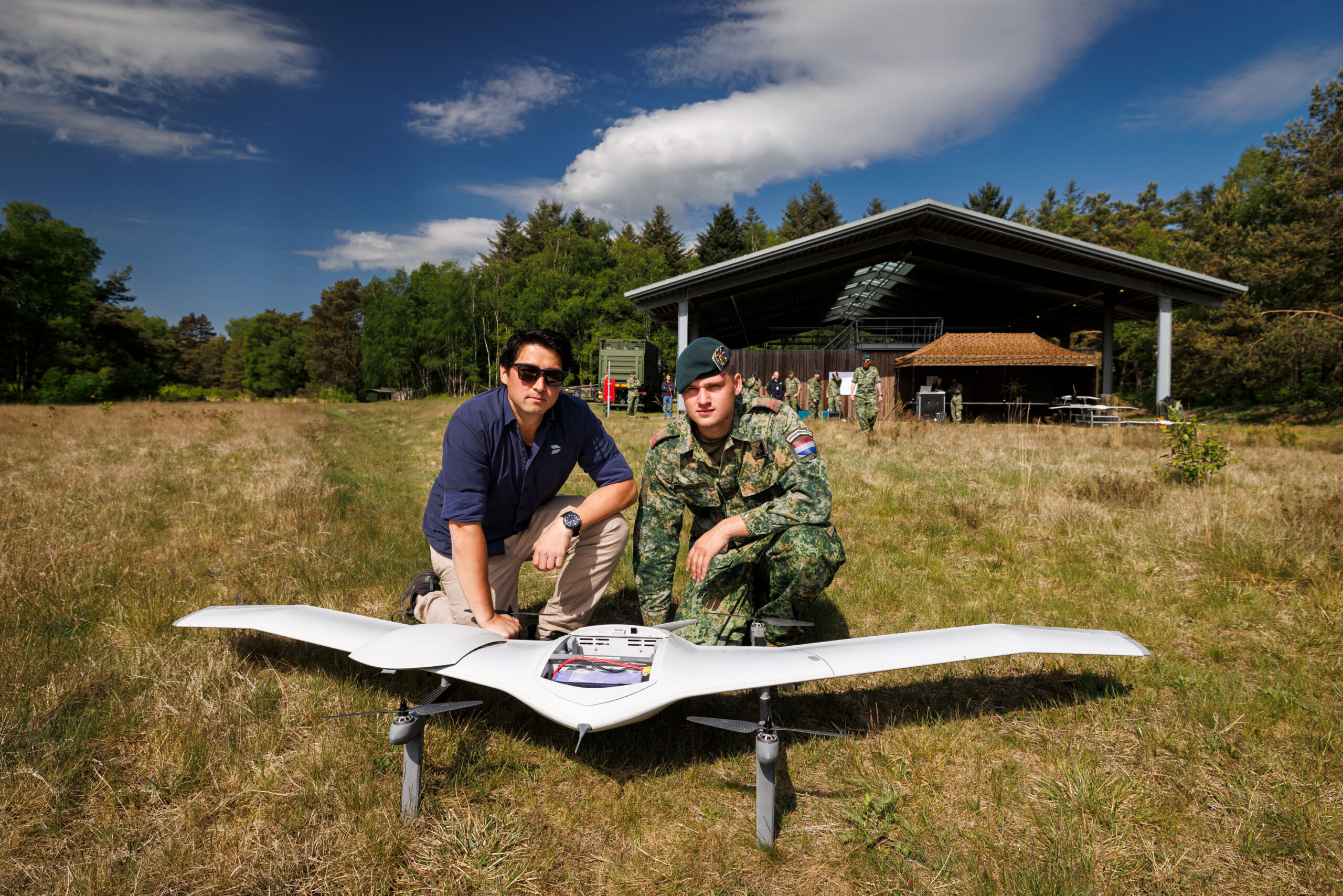
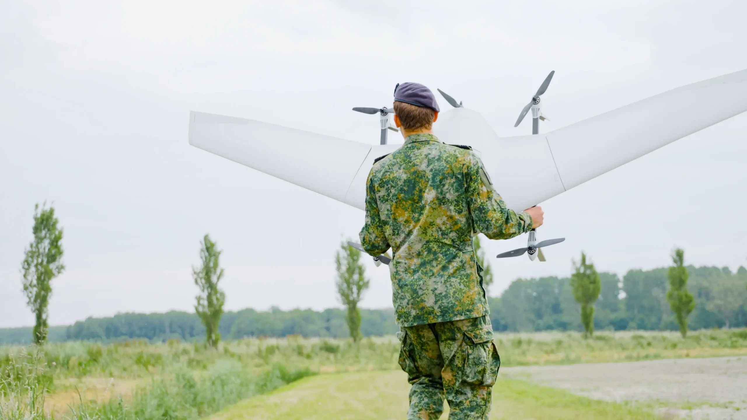
Operational Strength and Applications
DeltaQuad platforms support a wide range of missions where endurance, autonomy, and data quality are critical. Their UAVs are deployed for:
-
ISR and defense operations, providing high-endurance flight, long-range observation, and support for ISTAR-related missions.
-
Mapping and surveying, delivering efficient coverage and precise geospatial insights over large areas.
-
Infrastructure and asset inspection, helping industries monitor pipelines, grids, railways, and remote installations.
-
Environmental monitoring and public safety, offering persistent overwatch and access to areas where manned operations pose risk.
-
Critical transport, enabling rapid, autonomous delivery of essential goods across long distances.
These applications demonstrate DeltaQuad’s core strategy: empowering organizations with efficient tools that extend operational capability without adding complexity.
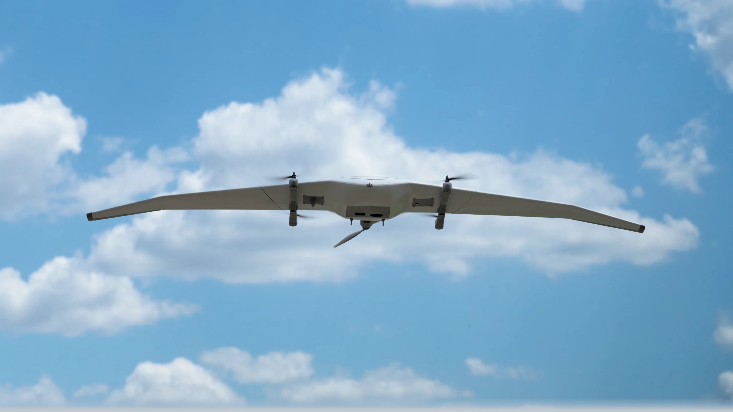
A Product Line Designed for Versatility (High-Level Overview)
DeltaQuad’s UAV platforms are engineered to balance long-range performance, operational autonomy, and payload flexibility. While the company’s flagship systems — including the latest evolution of its long-range UAV platform — incorporate advanced aerodynamics, modular payload bays, and fully autonomous mission execution, the emphasis remains on usability and mission effectiveness rather than technical abstraction.
The company continues to refine its long-range VTOL systems with improved endurance, increased payload options, stronger communication resilience, and enhanced safety features. By keeping design modular and open, DeltaQuad allows operators to tailor systems to their needs while avoiding unnecessary vendor lock-ins — ensuring long-term adaptability in a rapidly evolving industry.
European Manufacturing and Quality
DeltaQuad proudly designs and manufactures its UAVs in the Netherlands, supporting high standards of European aerospace engineering. Each system is built with durable materials, carefully tested, and optimized for long-term reliability. This manufacturing approach ensures consistent quality control, robust airframes, and dependable field performance even in harsh conditions.
The company’s focus on quality extends beyond hardware. Software, autonomy logic, and ground control interfaces are continually updated to reflect operational feedback and technological advancements, ensuring that each UAV evolves with the industry and remains a future-proof investment for operators.
Innovation Through Customer Partnership
DeltaQuad’s success is built on strong, long-term relationships with its users. The company actively collaborates with customers to understand their challenges, extract insights from field experience, and use those learnings to shape new product iterations. This collaborative model enables DeltaQuad to stay ahead of industry trends while delivering technology that aligns with real mission requirements.
Whether working with defense organizations, government agencies, energy companies, or geospatial specialists, DeltaQuad treats customers as strategic partners in innovation. Their input directly informs the roadmap of new capabilities, sensor integrations, and autonomous functions.
Vision, Mission, and Core Values
Vision
To create versatile UAVs that perform in the toughest environments while delivering reliable, high-value aerial intelligence.
Mission
To drive the future of unmanned aviation through resilient design, intelligent autonomy, and continuous innovation.
Values That Shape DeltaQuad
Customer Centricity
DeltaQuad places customer needs at the center of every decision. The company seeks to exceed expectations by ensuring users can fully rely on their systems in mission-critical situations.
Ownership
The team embraces responsibility and initiative at every stage of development, ensuring that each project is executed with dedication and accountability.
Innovation
DeltaQuad values bold but feasible innovation. The company pushes boundaries while ensuring solutions remain practical, scalable, and aligned with real operational needs.
Excellence
Attention to detail and high standards form the foundation of the company’s engineering and support culture. Excellence is embedded in every product and interaction.
DQ Family Culture
DeltaQuad cultivates a supportive environment grounded in trust, empathy, and teamwork. This culture drives long-term success and sustains the creativity needed to grow.
Moving Forward
DeltaQuad continues to expand its technological capabilities and industrial partnerships, strengthening its role as a leader in long-range VTOL UAVs. The company’s long-term commitment to innovation, reliability, and customer-focused engineering ensures it will remain a significant force in the evolving global UAV industry.
By combining European craftsmanship, advanced autonomy, and a deep understanding of user needs, DeltaQuad is enabling organizations worldwide to operate smarter, safer, and more efficiently — giving flight to solutions that matter.