


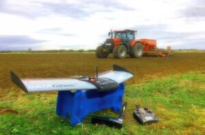


With the same reliable airframe as it’s survey brother, the DataHawk Agricultural drone carries the advanced MicaSense RedEdge, a high resolution multispectral sensor, designed and specifically calibrated for Agricultural operations.
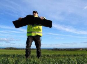
Quick setup with a powerful launch line system to achieve optimum launches is high wind conditions, or launch by hand, ability for auto landing, belly landing or parachute The DataHawk is able to survey and monitor crop health and large-scale plantation management, to get the below benefits: Multispectral images can be translated in to valuable indices and farm maps Reduced infield time vs.
multirotor drones, saving you time and cost The Datahawk PPK can identify crucial agricultural information on crop status, diseases, plant density, water stress and the impact of chemical and biological treatments Outputs Include: Topographic maps Soil erosion assessment & modifications Drainage designs/Field layouts Infrastructure maps Vegetation indices/Growth monitoring Plant counting/Density/Canopy gaps Diseases identification Impact of chemical/Biological treatments Temperature and moisture Water issues and irrigation systems
| Domain | professional |
| Applications | agricultural |
| Type | fixed-wing |