AI Pilot: How Far Has Navigation Autonomy Advanced?
Global Navigation Satellite Systems (GNSS) systems such as GPS have been a staple technology in land, maritime, and aerial navigation for decades. Super useful? Absolutely. But, GNSS has its fair share of downsides too.
Weather, buildings, natural obstacles, and some electronic systems cause inevitable signal degradation and latency in signal acquisition. Heavy reliance on a network of satellites and ground stations, attractive targets for physical or cyber-attacks, also raises rightful security concerns. For UAVs and ROVs, signal spoofing, jamming, and other forms of electromagnetic warfare (EW) are also a problem.
For many mobility scenarios signal loss or high latency is unacceptable, even more so if we’re to advance to full autonomy. But if not GNSS, what other technologies can provide reliable positioning and navigation data? A couple of options are on the table.
Sensor Fusion with AI
Every commercial UAV is equipped with a set of standard sensors, such as an accelerometer, gyroscope, compass, airflow sensor, and altimeter, for situational awareness. More advanced enterprise models may also include LiDAR distance sensors or ultrasonic sensors to detect proximity to obstacles.
Combined, these provide real-time information on the drone’s location, orientation, and movement, and a GPS/GNSS receiver tallies this with geo coordinates, which allow the drone to follow a pre-planned flight route. When GPS is down, the best models will hold position or attempt to automatically return home.
Yet, recent advances in sensor fusion also enable autonomous navigation scenarios. Instead of the GPS signal and pilot commands, the drone can rely on data from its Inertial Measurement Unit (IMU) and AI navigation algorithms to safely continue the route. By integrating and processing sensor data streams on the device, AI pilot models can provide precise situational awareness to drones and full autonomy.
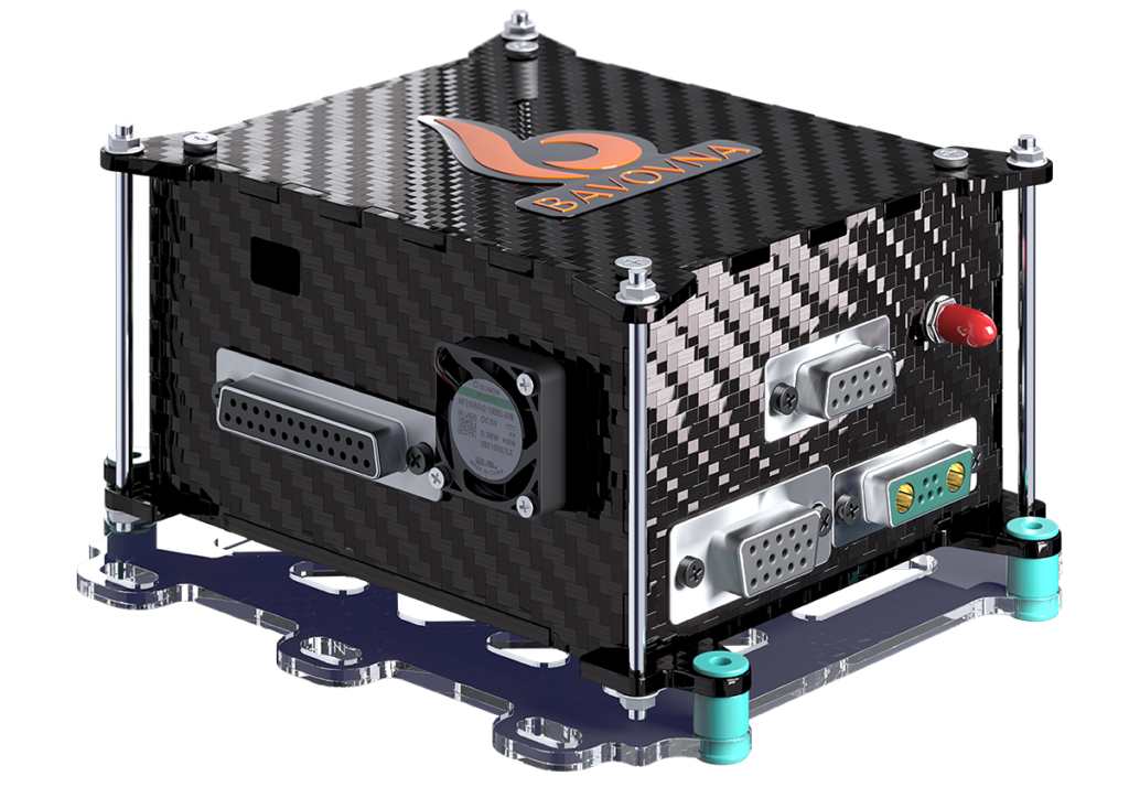
Bavovna Navigation Kit includes an 800gr/28 oz onboard edge devices and SaaS access to a fine-tuned AI Hybrid navigation model, pre-trained on historical data from the available sensors. Already implemented on eight UAV platforms, ranging from fixed-wing and VTOLs to multi-copters and FPVs, the system maintains an End Point Positioning Error (EPPE) of under 0.5% on complex trajectories of up to 30 km or 18.6 miles.
Intended for dual use, Bavovna’s hardware sits in an EMI-protected case and can be further augmented with a SIGINT RF module for bypassing EW and EM obstacles. AI pilot system, not only enables more reliable autonomous navigation but also improves obstacle detection, UAV routing, and ultimately operating efficiencies.
LiDAR-Based SLAM Systems
An alternative approach to sensor fusion is the Simultaneous Localization and Mapping (SLAM) technique. While sensor fusion primarily relies on IMU data, SLAM algorithms use camera and LiDAR data to general a real-time map and localize AI pilot system in a GPS-denied environment. Opposed to cameras, 3D LiDARS provides an immediate point cloud of the environment, eliminating the latency. Data processing software has to be installed both on the flight controller and the onboard computer.
SLAM algorithms like LOAM and Cartographer have demonstrated great performance during scientific experiments in terms of trajectory execution and landing errors. Commercially, Elios 3 from Flyability and Hovermap series from Emesent, and Scout 137 from ScoutDi rely on SLAM for indoor navigation in GNSS-denied environments (with an added bonus of advanced mapping scenarios).
The downside of photo-SLAM, however, is high resource consumption: CPU, memory, and processing, especially for photo-realistic mapping scenarios. This, in turn, requires heavier and more expensive onboard units, which increase the system operating costs. Likewise, high resource consumption results in faster battery drainage on smaller UAVs, undercutting the precious flight time. Although some recent advancements in processing frameworks help optimize resource usage.
AI Pilots: Navigation Guided by Magnetic Fields
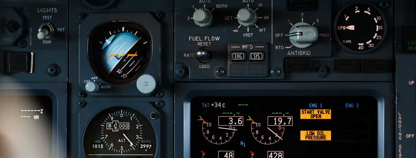
Commercial and military aircraft are also increasingly relying on AI-assisted navigation, oftentimes powered by hybrid INS/GPS signals. For security reasons, however, the military is looking to progressively minimize reliance on satellite networks.
The US Air Force has been continuously testing different AI pilots to autonomously pilot fighter jets. Technologically, we’re already there — AI systems successfully piloted an F-16 in a dogfighting exercise over California’s Edwards Air Force Base in May 2024. But there’s always room for further improvements.
The Air Force research team is working on a new AI pilot navigation to potentially navigate the plane using the Earth’s magnetic fields. So far, such scenarios haven’t been feasible as the aircraft generate too much electromagnetic noise, interfering with onboard magnetometer measurements.
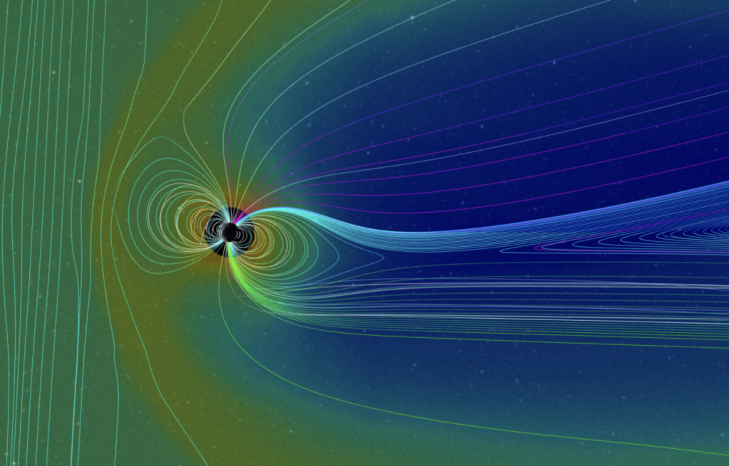
However, a recent model, tested on C-17, showed very promising results that could lead to “tactical airdrop quality” and a potential solution to “things we can do, should we end up operating in a GPS-denied environment.“, according to Col. Garry Floyd, director of the Department of Air Force-MIT Artificial Intelligence Accelerator program.
While we may not be there yet, widespread autonomous AI pilot without GNSS is no longer a question of “if”, but rather “when”, especially for unmanned aerial vehicles.