Best Long Range Drones

Best Long Range Drones 2025

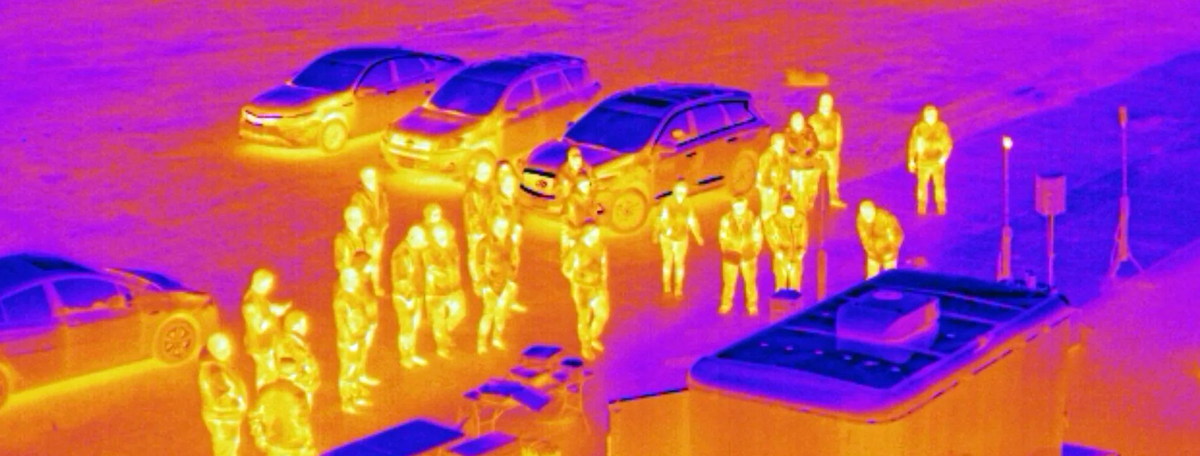
If you’re looking for a reliable drone for tactical, security, mapping, or surveying missions, you’ll need a model with a long-range. The newest fixed-wing VTOLs boast an impressive range of up to 1500 miles and an extended flight time of up to an entire day.

Long Range Drones: Summary Table

ModelRangeFlight timeKey features
Spirit-X500 km (311 miles)500 km (310 miles), at 150 km (93 miles) an hourZero emission hybrid electrical VTOL Integrated hydrogen fuel cell power system Payload capacity of up to 150 kg (330 lbs.) or 1,470 liters / 52 ft 3 Autonomous piloting mode 
Raybird Up to 2500 km (1553 miles)Up to 28 hoursTactical unmanned aerial system EW threat protectionUp to 5kg in payload capacity Catapult mechanical launcher available  
Tekever AR3 Long-range VTOL100 km (62 miles8 to 16 hours Long-range, high endurance UAV Dual-side looking SAR Integration with a range of sensor optics and payloads All-terrain retreival
Trinity PRO 100 km (62  miles)90 minElectrical, vertical takeoff, fixed-wing UAV Quantum-Skynode autopilot Native compatibility with 5 cameras Portable base station to enable high-precision PPK processing
Fly Dragon FDG24 240km (150 miles)210 minElectrical, vertical takeoff, fixed-wing UAV Reinforced carbon fiber composite airframe IPX4 water ingress rating 25m/s average cruising speed 

Gadfin Spirit-X

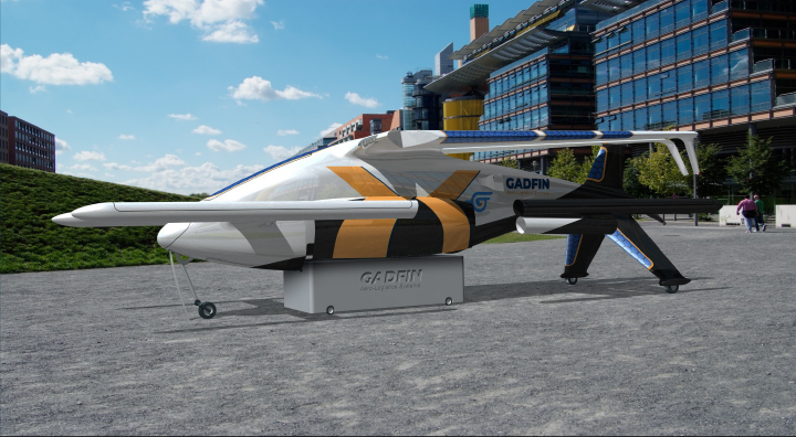
Gadfin is one of the top innovators in the long-range fixed-wing drone market. Spirit-X, one of its latest releases, boasts an impressive range of  500 km (311 miles), thanks to a hybrid powertrain, fueled by hydrogen fuel cells. The underbelly box can fit up to 100 kg (220 lb) in cargo or can be used to attach heavy-weight payloads. Foldable low wing, in turn, allows takeoff in landing with limited surface area, making it ideal for urban drone deliveries or rescue missions.  

Key characteristics:

  • 150 km/h (93 mph) cruising speed
  • Fold-out wings and carbon fiber fuselage 
  • Fixed tricycle wheeled landing gear
  • Distributed Electric Propulsion (DEP) redundancy system 
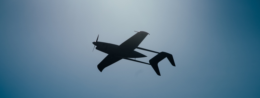
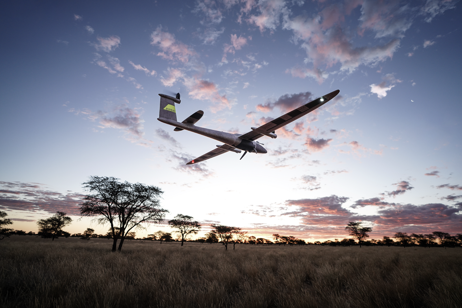
Raybird


Ukrainian startup Skyeton built a compact, but mighty UAS for military, security, and surveillance missions. Assembled in just 25 minutes, Raybird can stay in the air for 28 hours. The digital data link stays strong for up to 120 km (75 miles), although the range can be extended to up to 2500 km (1553 miles). A customizable, hot-swap payload bay can accommodate any camera, SAR, night vision, and laser target designator gear. 

Key characteristics:

  • 18-28 hour flight time
  • 5kg payload capacity 
  • 25 min assembly time 
  • 4500 m max altitude 

Read our full review of Raybird UAS

Tekever AR3 

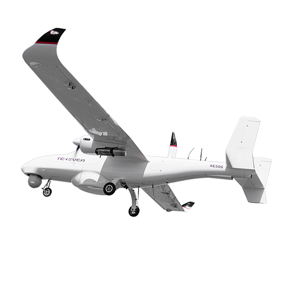
Portuguese Tekever produces a great lineup of modular, long-range VTOLs.  AR3 is one of its best models because it’s packed to the brim with amazing technologies: a Synthetic Aperture Radar, common GCS with A4, A5, and A3, a recovery parachute, a customizable payload bay, and an optional BVLOS data link to the boot. It’s a marvelous model for a roster of land and sea-based missions.

Key characteristics:

  • Up to 90 km/h (55mph) speed 
  • 4 kg (8.8 lbs) payload capacity 
  • 16-hour max flight time 
  • 25 kg (55lbs) max takeoff weight
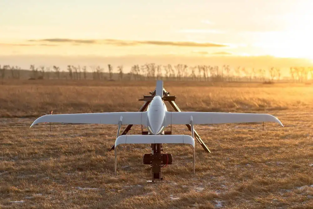
Trinity PRO

Trinity PRO eVTOL from Quantum Systems is a ‘nerdy’ sidekick for long-range mapping missions. Boasting a Quantum-Skynode autopilot and Linux-based mission computer, this UAV can be easily upgraded with extra AI capabilities and downstream payload integrations. A native GNSS module and complementary QBase 3D software make Trinity PRO one of the best long-range drones for land surveying and mapping missions

Key characteristics:

  • 90min flight time
  • 700ha area coverage
  • 18m/s wind tolerance
  • 5.75 kg (12.7 lbs) max takeoff weight 
  • IP 55 rating 

Fly Dragon FDG24 

Chinese Fly Dragon produces robust, affordable long-range fixed-wing drones with four rotors for smooth takeoff and landing. It can carry up to 1.6 kg (3.5 lb) in payloads for up to 3.5 hours, making it a great choice for different industrial use cases — building inspection, crop monitoring, site surveying, or emergency mission patrols. A sturdy airframe made of carbon fiber composites and an IPX4 ingress rating guarantee the gear’s long service life. 

Key characteristics:

  • 25m/s cruising speed 
  • 240 km max range 
  • 210-minute flight time 
  • 10 kg/22lbs max take-off mass
  • Level 5 wind resistance 

Discover even more long-range UAVs from our directory

thermal drone

How to Choose a Thermal Drone

A thermal drone is great gear for a variety of missions — from surveillance and security patrolling to industrial asset inspection. And there’s been plenty of new model releases over the last year. 

But with a sharp price tag, the “cheapest” models start at $6K, so you don’t really want to wing it (pun intended). Learn how to choose the right thermal drone from our quick guide. 

Important Thermal Drone Features To Consider 

To choose an all-around pleaser, check each option against these criteria: 

Thermal Camera Settings 

Many Electro-optical (EO)/Infrared (IR) camera payloads for drones are available. Look for systems with a resolution of at least 640 x 512 px for crisp images. 

A broad spectral band in the IR sensor is advantageous for better scene recognition and performance under various weather conditions (e.g., fog, rain, snow). Check if you can set custom isotherm ranges manually to further tune your equipment for the use case.

The best thermal imaging drones combine thermal sensors with an RGB camera for an impeccable shooting experience.

Radiometric Functionality

Thermal drones with radiometric features capture precise temperature readings, rather than differences in ranges. This allows you to calculate precise data in measured area (min, max, average °F/ °C), giving a broader read of trends. For example, you can evaluate heat distribution across industrial pipelines to measure thermal efficiency.

Some thermal drones can be auto-programmed to focus on specific temperature ranges for streamlined data collection. For example, you can set a custom range to inspect temp variations in cold storage rooms to detect heat loss.

Gimbal Stabilization

A solid gimbal reduces blur in thermal footage, especially models with gyroscopic stabilization. It also provides extra angular velocity to track fast-moving targets 

(e.g., if you’re using a thermal drone for border security tasks). 

Flight Time and Range

Most enterprise quadcopters can stay airborne for 30 to 50 minutes, depending on weather and load. Larger fixed-wing and VTOLs like Albatross UAV can cruise for up to 4 hours at 20 m/s (and it can be equipped with a thermal camera payload). 

Range matters for covering larger areas. Advanced drone transmission systems can sustain a steady range of up to 6-9 miles (10-15 km).

For extended operating time, you can choose a tethered thermal drone, which can hover for days when connected to a power source. With Bavovna’s AirTower Mode, tethered drones can operate fully autonomously even in GPS-denied environments.

Environmental Durability

The best thermal drones boast exceptionally high endurance, including wind resistance up to 23 knots, IP55 rating against water and dust damage, and built-in redundancies. For safe missions, look for models with redundant properrels, INS components, and motors.

Best Thermal Drones for 2025 

Need some recs? Here are the top picks from Bavovna’s team:

  • Skydio X10. Measuring just 31.1” x 25.6” x 5.7”, Skydio X10 can stay in the air for up to 40 minutes with a max speed of 45mph. The hybrid imaging system combines a narrow 64MP RGB camera, a 48MP telephoto one, and a radiometric thermal camera with  640 x 512 px resolution and under 30mk sensitivity. 
  • Autel EVO Max 4T. With an IP43 rating and an extra pair of hot-swappable batteries, Evo Max 4T is a reliable companion for a range of missions. Equipped with a hybrid RGB/thermal camera, this UAV can muster an impressive temperature Measurement Range of -20°C to 550°C. GPS-denied navigation mode is a great bonus.
  • Inspired Flight IF1200. IF1200 model from Inspired Flight is sturdy and robust. It can lift up to 19.1 lbs in payloads while staying in the air for 35 to 43 minutes. It’s compatible with the Gremsy VIO F1 thermal camera, featuring a 4K zoom sensor, a 640×512 radiometric sensor, and an integrated 2400m laser rangefinder. Thermal sensitivity range is ≤ 50 mk, giving you crisp imagery under any flight conditions. 

Discover more UAV companies in our directory

uav mapping

Primer on UAV Mapping

Collecting aerial data used to be a daunting challenge. Tape measures, foot patrols with a theodolite, or cost-inhibitive helicopter flights. 

Unmanned aerial vehicle (UAV) mapping changed the aerial data collection game, bringing extra speed, lower costs, and greater precision. 

New to the concept? Here are the essentials you need to know about UAV mapping. 

UAV Mapping and Surveying Use Cases 

Fixed-wing UAVs, VTOL drones, and enterprise quadcopters can stay in the air for up to an hour (and sometimes more), giving surveying teams ample time to perform various geodesic tasks. The best mapping drones also include specialized payloads for high-precision data collection like thermal cameras, multispectral sensors, magnetometers, gas detectors, and LiDAR systems for 3D scanning. 

Here’s how businesses use UAVs for surveying and mapping tasks:

  • Topographic mapping. Drones help create HD orthomosaics and 3D models for cadastral surveying, allotment planning, and a host of other civil surveying use cases. Swiss Canton of Valais used a WingtraOne mapping drone to conduct mountain village land surveys in 3 days, instead of 2 weeks with conventional methods. 
  • Mining exploration. Using drones, operators can assess resources and plan excavations based on geospatial information. Rugged, in-door models also help assess sub-terrain corridors to ensure safe and effective operations. WACO S.R.L. used the Elios 3 drone to inspect dangerous rock detachments inside its quarry (Italy), providing teams with valuable operational data. 
  • Urban planning. City planners rely on UAVs to collect visual data for 3D modeling, land classification, and smarter resource allocation. Thanks to automated route planning and high-precision data capture, drones substantially reduce the cost and fieldwork hours. A surveying team in Weinan City, China, used drones to collect oblique cityscape imagery with greater efficiency. Based on this data, a comprehensive 3D model was created with an accuracy level of up to 5 cm.
  • Road construction surveying. For large-scale transportation projects, UAVs provide seamless data capture for large-area linear maps, reducing the complexities of planning, monitoring, and documenting new construction projects. The Norwegian Public Roads Administration uses drones to survey underway projects more effectively. Mapping a 3-mile road with a drone can take just 2.5 hours and $270 in labor costs vs 6 days and $5,200 with terrestrial laser scanners. 

Shortcomings of UAV Mapping 

Although UAV mapping comes with a slew of benefits, it’s still a tedious process, susceptible to different disruptions. 

Weather can be a major factor as lighter, commercial models are inoperable in high winds, heavy rain, or snowfall. Fog, in turn, can cause sensor interference, increasing the risks of collisions and data capture accuracy. 

Terrain type can also aggravate the UAV’s technical limitations, leading to signal loss, mapping errors, and scrambled navigation. Dense vegetation, large water bodies, mountains, sudden elevation changes, and high-rise buildings, limit GNSS/GPS signal propagation. In such cases, it’s worth looking into a solution for GPS-denied navigation

Regulations. Many UAV aerial mapping use cases require BVLOS permissions, which may be hard to obtain in certain jurisdictions due to bureaucratic red tape. Drone operators must also comply with privacy requirements, as well as other rules related to flying over people and close to restricted areas. 

Data accuracy. Although drone technology has made major leaps, technical limitations still remain. Automated, on-device data processing can impact footage quality and accuracy. Also, discrepancies between vertical measurements can vary significantly without Ground Control Points (GCPs). On average, you need to place 12 GCPs for small to medium sites 

(7 and 39 ha) and up to 18 for the large sites (342 ha). This adds extra workload for field teams. 

Improving UAV Mapping with Bavovna Hybrid INS 

Overcome the challenges of GPS signal obstruction with Bavovna Hybrid INS Navigation Kit. Measuring just 150 x 134 x 73 mm, Bavovna kit enables reliable, long-range navigation with AI-powered sensor fusion. Custom-trained for each drone and a variety of operational scenarios, Bavovna helps operators fly mapping missions without getting held back by signal propagation delays, interferences, or drift bias. 

Discover Bavovna Hybrid INS Navigation Kit