Unmanned Ground Vehicles

The Tech Behind Unmanned Ground Vehicles: AI, Sensors, and Autonomy

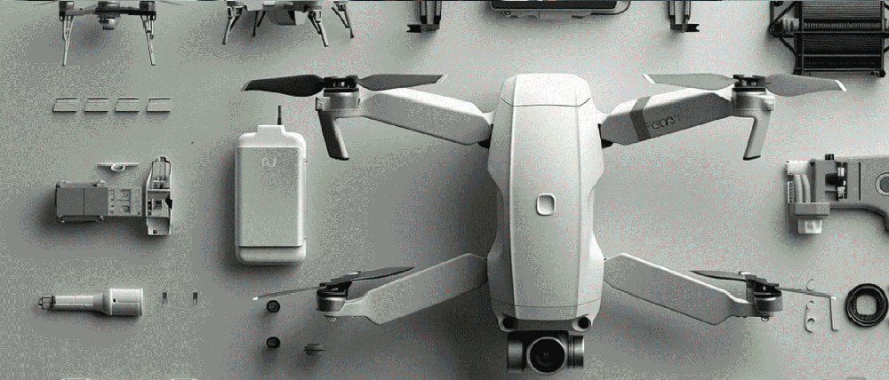
Unmanned ground vehicles are evolving into fully capable robotic platforms. They integrate sensor arrays, edge computers, and AI models that read terrain, plan routes, and process decisions at machine speed. The focus is shifting from the mechanical frame to the technology stack that transforms raw inputs into precise navigation and mission-ready intelligence. In this post, we break down the core layers behind modern UGVs: perception sensors, navigation systems, and the AI engines that power autonomy.

This post looks into the ‘stack’ inside modern UGV that guides its movement and provides real-time intelligence for decision-making. 

1. Perception Sensors

At the center of every UGV lies a robust sensor array — its eyes and ears in the world. The two main categories are: 

  • Exteroceptive sensors such as LiDAR, radar, ultrasonic sensors, and various types of cameras help sense the surroundings. They help detect obstacles, map terrain, and prevent collisions. 
  • Proprioceptive sensors like inertial measurement units (IMUs), vehicle odometry, and GPS/GNSS are focused on tracking the UGV’s internal state: its speed, orientation, and position in space. 

The exteroceptive sensors often reinforce one another. For example, LiDAR can help deliver real-time 3D point maps of unknown terrain for greater spatial understanding. But it can be unreliable in poor weather conditions or near reflective surfaces (not to mention its price). Meanwhile, radars perform better in poor visibility conditions  (e.g., rain, fog), but offer lower spatial resolution than LiDAR. 

Some unmanned ground vehicles also rely on computer vision cameras and edge-deployed algorithms for perimeter scanning. While more compact models use ultrasonic sensors for
close-range obstacle detection. 

The key to peak performance? Sensor fusion. By meshing data from multiple sources — LiDAR for structure, radar for range, cameras for detail, and IMUs plus GNSS for location — UGVs form a reliable, accurate perception of their surroundings.  And this is something we do with our AI Navigation Kit

2. Navigation and Autonomy Components 

The next tech challenge is to make UGVs localize themselves and move purposefully, with varying levels of autonomy. 

Most vehicles rely on a GNSS (GPS) and INS (inertial navigation systems) combo for global and relative positioning that you need for mapping and waypoint tracking. Indoor UGS, in turn, may use laser beacon systems or marker-based navigation for pinpoint control. 

When it comes to autonomy, UGVs fall along a wide spectrum. At one end are fully teleoperated vehicles, where a human operator directs every movement. In the middle are semi-autonomous systems, which combine remote guidance with onboard assistance.
At the far end are fully autonomous vehicles, where AI independently makes navigation and task decisions.

For full autonomy, modern unmanned vehicles may rely on: 

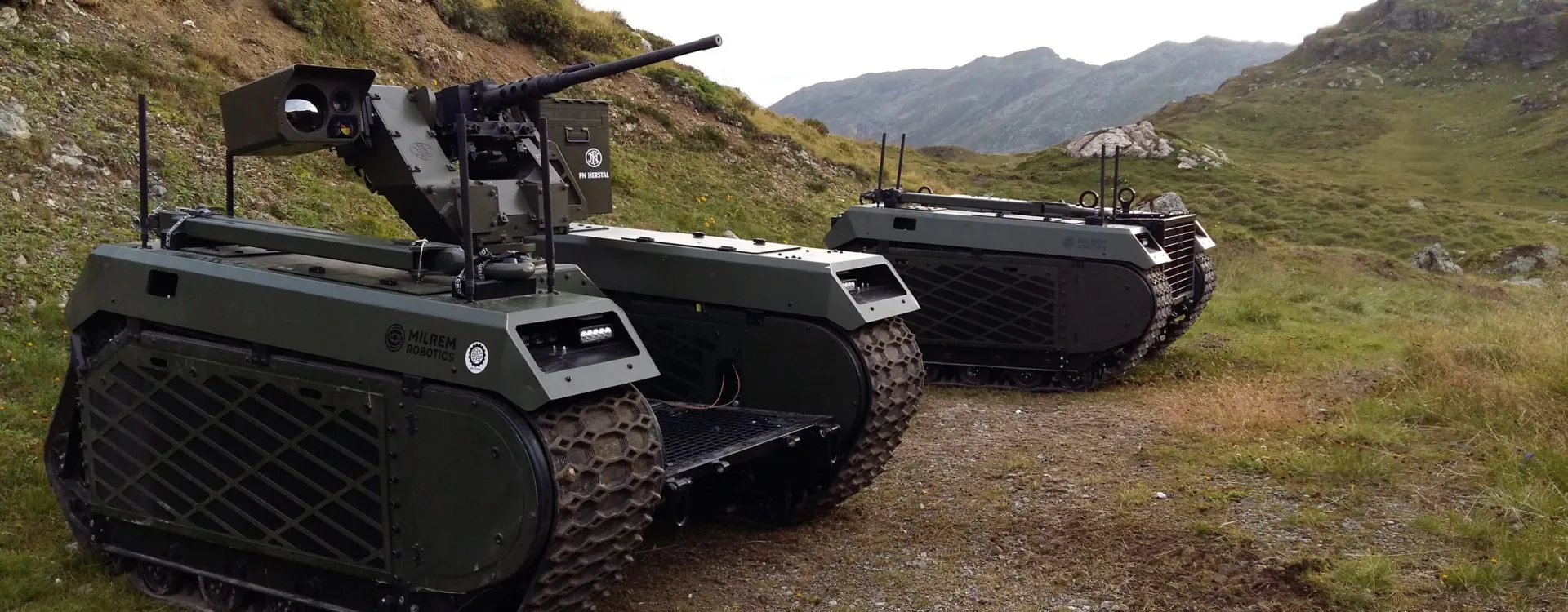
Some systems, like Oshkosh’s TerraMax, combine LiDAR, multiple radars, cameras, and infrared sensors in a modular package for both autonomous and human-operated convoy control.

3. AI & Decision-Making

AI acts as the ‘brain’ for the bots that translates raw input data into adaptive, context-aware behavior.

Most UGV systems use pre-trained machine learning for object recognition, terrain analysis, and dynamic decision-making. This allows the vehicles to adapt to new scenarios on the fly and progressively improve their performance over time. 

New research is also pushing AI beyond navigation and into tactical autonomy. For example, one research group fused vision-language models with compact large language models to interpret complex battlefield scenes and craft multi-agent strategies, bridging perception and decision within a unified semantic space.

New AI systems are also being designed to monitor their own decision confidence. A recent framework used decision trees combined with predictive control to detect navigation errors or sensor faults and autonomously initiate recovery strategies, making UGVs safer and more reliable in uncertain environments. 

Lastly, more and more UGVs come with hybrid control models, where human operators and robots share decision-making. This approach lets robots handle routine or tactical decisions while humans intervene at strategic or safety-critical junctures — a balance between autonomy and oversight.

Looking Ahead

UGVs are no longer experimental prototypes. With sensor fusion, adaptive AI, and modular autonomy frameworks, they’re becoming trusted operators in defense, logistics, and industrial inspection. The pace of advancement makes one thing clear: the ground domain is entering an autonomy-first era

If you’re exploring how to equip your ground or aerial fleets with next-gen autonomy in GNSS-denied conditions, Bavovna’s AI navigation kit delivers proven field performance. Book a demo to see how our AI hybrid INS system can supercharge your mission. 

uav radar

4 Types of Radar UAV Payloads For Mission Edge

Most commercial drones come equipped with ultra HD, CMOS sensor-based cameras offering a crisp picture from the sky. But what if you need to fly at dawn, dusk, night, or through other environments where optics fail? That’s when UAV radar payloads step in. 

Radars turn drones into all-weather, all-terrain sensors, capable of spotting threats, mapping terrain, and holding altitude where other systems stumble. Below, we break down four popular UAV radar payload types (each with distinct strengths) for operators looking to give their platform a real mission edge.

Synthetic Aperture Radar (SAR) Payloads

SAR is a weather- or light conditions-agnostic alternative to using high-res cameras for UAV navigation. By analyzing echoes from bounced radar signals, it builds rich two- or three-dimensional images of landscapes, structures, and even hidden-from-view objects. For drones, that translates to extra ‘vision’ powers. 

Where optical sensors falter, SAR payloads keep watch over the UAV mission. For example, to assess damage or detect intruders at night, track camouflaged vehicles under foliage, or run UAV surveying missions through thick clouds or fog.  

The trade-off? SAR systems are larger, heavier, and need serious on-board processing power (aka not suitable for your average quadcopter). But if your mission calls for wide-area situational awareness in any conditions, SAR is a great choice for larger drones

Use cases:

  • Coastal and border security 
  • Disaster response and damage assessment
  • Camouflage penetration and terrain change detection
  • Wide-area military ISR in GPS-denied zones

Pulse-Doppler Radar Payloads

While SAR relies on static imagery, Pulse-Doppler radar leverages movement.  It measures tiny shifts in frequency to distinguish moving objects from a static background. For instance, a  Pulse-Doppler radar-equipped UAV can detect interceptor drones in contested airspace, spot speeding trucks, or zoom in on small boats against rolling seas. 

The big win here is clutter rejection: Pulse-Doppler radars are built to ignore background noise and lock onto moving threats. The downside? They can’t match SAR’s detail for static imaging. But if your priority is tracking what’s moving, Pulse-Doppler is the go-to.

Use cases

  • Counter-drone detection and tracking
  • Vehicle and aircraft pursuit in contested areas
  • Anti-smuggling operations detection
  • Real-time battlefield movement monitoring

Altimeter Radar Payloads

Altitude control is critical when you’re flying in dense urban areas, through rugged terrain, or in hostile territories. A few meters too low, and you risk losing your platform. Radar altimeters supply UAV operators with precise distance from the UAV to the ground, even when GPS is jammed or visibility nears zero.

Think of the cases where you need to lend near water, among heavy smoke, or amidst dense buildings. An onboard radar altimeter makes sure it stays at the right height — or touches down smoothly — no matter what the environment throws at it. 

Altimeters aren’t foolproof.  But as part of a broader payload mix (and with AI sensor fusion applied!), it can be a powerful add-on for safely cruising through difficult, GNSS-denied conditions.

Use cases

  • Precision landing in zero-visibility conditions
  • Terrain-following flight over rough or mountainous areas
  • GNSS-denied or spoofed environment operations
  • Flight safety for BVLOS missions

FMCW Radar Payloads

Frequency-modulated continuous-wave (FMCW) radar is the lightest and most compact UAV radar out of the pack. Thanks to digital signal processing, the FMCWs of today far exceed their predecessors in terms of resolution, efficiency, and versatility. Instead of sending radar signals in bursts, it continuously varies frequency to measure both distance and velocity. The result? Exceptional accuracy at close to mid-range.

This makes  FMCW a great UAV payload for collision avoidance and navigation in ‘busy’ environments. Think close-to-structure work like power line or wind turbine inspections. The technology can also aid with autonomous navigation in GPS-denied areas where obstacle detection is a must.

Yet, FMCW can’t match SAR or Pulse-Doppler for long-distance detection. But when space and weight are tight, and you need a reliable proximity sensor, it’s hard to beat.

Use cases:

  • Obstacle detection and avoidance near infrastructure
  • Urban or industrial inspection flights
  • Safe operations around power lines, wind farms, or towers
  • Autonomous UAV flights, together with other sensors

To Sum Up 

Each radar payload brings something different to the table. SAR delivers wide-area mapping in any conditions. Pulse-Doppler specializes in tracking what moves. Altimeter radars keep UAVs steady when GNSS falters. FMCW radars excel at short-range navigation and obstacle avoidance. 

The real edge, though, comes from pairing these payloads with a drone navigation system that doesn’t falter under pressure. That’s where Bavovna’s AI Hybrid Navigation Kit comes in. Purpose-built for GNSS-denied missions, it can fuse data from any number of sensors — IMU, radars, LiDAR, and more — to supply your UAV with accurate navigation data. If your goal is uncompromising performance in the toughest conditions, we know how to get you there.

Confirm that you are not a robot.