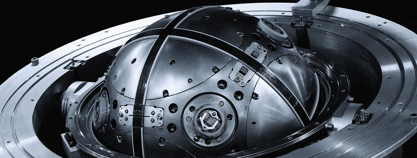
An internal reference unit (IRU) is a three-axis system that provides precise attitude, velocity, and navigation information to the vehicles using internal sensors. Unlike basic sensor arrays, an IRU applies sensor fusion technologies to correct errors and estimate PNT with higher precisions, enabling seamless navigation in GPS-denied environments.
Components of Inertial Reference Unit (IRU)
IRU processes data from internal sensors to provide navigation, stabilization, and autonomous functionality to piloted vehicles. Depending on the sensor combination, an IRU can continuously measure angular acceleration, linear velocity, attitude (roll, pitch), position, platform azimuth, magnetic and true heading, body angular rates, and more.
The most common IRU sensor components include:
- Gyroscopes: Measure rotation rate around three axes — roll, pitch, and yaw
- Accelerometers: Mesure linear acceleration to determine changes in speed and position
- Magnetometer: Measures the orientation relative to the Earth’s magnetic north to determine heading direction
All collected raw data is processed on the edge to optimize output accuracy with Kalman Filtering — a probabilistic data fusion algorithm that corrects for noise and drift to provide more accurate PNT data to the vehicle. IRU can also perform dead reckoning calculations to enable navigation in GPS-denied environments. Processed data is immediately transmitted to the flight controller through SPI, I2C, or CAN for real-time course correction.
IRUs are the key component of many autopilot systems in commercial aviation and maritime vessels.
Inertial Reference Unit (IRU) vs Internal Measurement Unit (IMU): What’s the Difference?
An internal reference unit and an internal measurement unit are the main components of modern internal navigation systems (INS). But each serves a slightly different purpose.
- An IMU only aggregates raw internal sensor data without applying any extra computations.
- An IRU collects and processes raw data to create precise position, velocity, and orientation outputs.
In most cases, the IMU plays a supporting role. It provides extra inputs for redundancy or slight course correction when GPS is used. IMU data can also be combined with visual inputs from cameras or LiDAR to enhance simultaneous localization and mapping (SLAM) algorithmic outputs. Or, in the case of Bavovna, used as part of an AI-powered navigation solution.
IRU, in contrast, may work in conjunction or independently from other external systems (e.g., GNSS) to provide a higher degree of autonomy and reliability. But that also comes at a higher price tag. Honeywell’s internal reference systems, used in many private and commercial jets, have a starter price of $300,000. Each also weighs anywhere between 9 and 40 pounds. This inhibits IRU’s usage for UAVs.
Bringing the Power of IRU to Drone Navigation
The main advantage of IRU is on-edge data processing which enables more advanced, autonomous aerial navigation scenarios. But that comes at a ‘cost’ of larger hardware size because commercial IRUs include large processors, memory storage, and sometimes redundant system components.
IMUs, in turn, are optimized for lightweight applications like drones, which come at a ‘cost’ of limited processing powers. At Bavovna, we’ve decided to solve this problem with the help of AI. Rather than trying to enable continuous on-device processing, we’re pre-training AI algorithms locally on the vehicle flight data. Effectively, we’re helping UAVs develop ‘memory’ and then use it autonomously in the field.
For example, we’ve successfully trained a model for AirTower flights — fully autonomous ascending and descending to set height, hoovering, and returning to a designated landing point without any GNSS connectivity with a 0.5% positioning error. Similarly, we trained other drone models to fly more complex trajectories with 98% accuracy.
Discover how Bavovna enables high-precision aerial navigation with an AI-powered INS solution.

