Interceptor Drones Without GPS: What Keeps Them on Course?
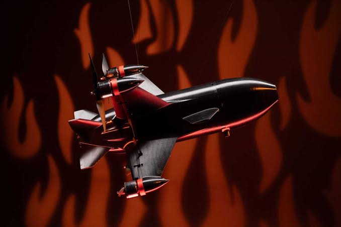
Interceptor drones have proven their mettle as a more cost-effective defence against missiles, loitering munitions, and more recently — jet-powered reactive strike drones. Available in almost every size and configuration — from drone-in-a-box to hybrid VTOL platforms — interceptor UAVs are now being actively ‘recruited’ for service.
But one pressing question remains: can interceptor drones remain useful when satellite positioning drops out, or when it gets fed false coordinates?
At Bavovna, we’ve been helping all sorts of UAVs stay on course despite the cruising conditions, with our AI navigation kit. And for those who’re curious, we’re lifting the curtain on how inertial sensing and complementary measurements fit together to keep interceptor drones on course.
What Happens to Interceptor Drones When GNSS/GPS Drops?
GNSS is a well-known weak link in UVAs. It’s susceptible to:
- Jamming, which overwhelms the receiver with stronger signals
- Spoofing, which supplies misleading signals that can produce a false position
With jamming, the flight controller loses a reference for position and velocity. Gyroscopes and accelerometers can still support attitude stabilisation, so the aircraft may remain operational. But without sufficient aiding, the onboard estimator (often an extended Kalman filter) will inevitably accumulate noise and bias, leading to velocity and position errors. So the interceptor drone will be as lost as a drunk pigeon.
Spoofing creates a different peril. When the estimator gets fed with false measurements, it can corrupt its position estimate and provoke inappropriate course corrections. What happens next depends on the platform, available sensors, and failsafe configuration. Position-dependent flight modes may become unavailable. Or the drone autopilot may switch modes or initiate landing. In both cases, the interceptor fails to do its job.
How Interceptor Drones Stay on Course
A lost GPS signal doesn’t immediately stop the interceptor’s movement. But knowing you’re moving and knowing exactly where you are are two different things.
To maintain accurate positioning data without GNSS, interceptor drones usually rely on inertial navigation, additional sensor measurements, and software that can make sense of them together.
Inertial Navigation Tracks Movement
Most interceptor drones have two handy components:
- An inertial measurement unit (IMU) contains accelerometers to measure linear acceleration and gyroscopes to measure angular velocity
- An inertial navigation system (INS) combines their measurements with computation to estimate motion from an initial state.
Neither of these sensors requires satellite connectivity or a radio link to measure movement.
But the catch is drift. Bias, noise, airflow, and temperature effects introduce accumulating errors. Gyro performance matters particularly because an orientation error also distorts how the system accounts for gravity. That contaminates the acceleration estimate and, eventually, the calculated velocity and position.
In other words: an IMU keeps measurements flowing, but it doesn’t guarantee indefinitely accurate coordinates. For that, you need extra sensors and onboard sensor fusion.
Extra Sensors Add Different References
Additional on-board sensors help interceptor drones compensate for different shortcomings.
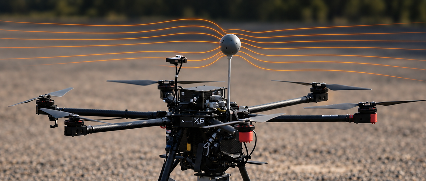
For example, multidirectional airflow sensors measure both airspeed and airflow direction, giving the flight controller more information about crosswinds and changing aerodynamic conditions. Combined with inertial measurements, those inputs can support steadier flight and better compensation for wind-induced drift when GNSS is down.
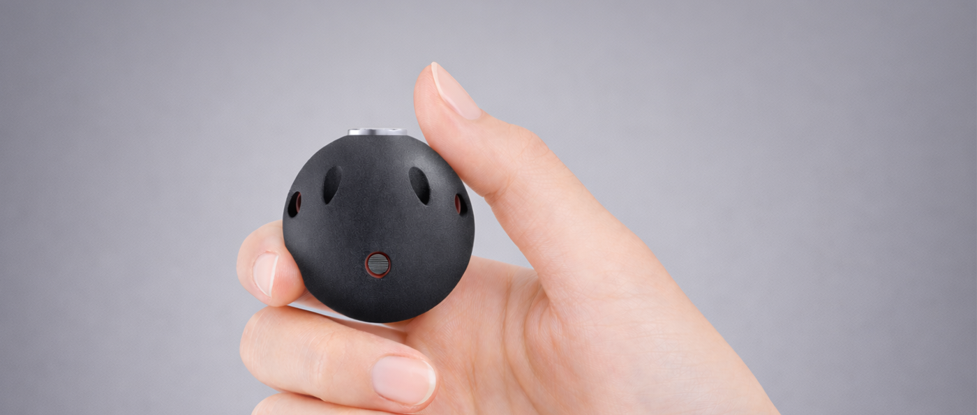
Bavovna’s Multivector AirFlow Sensor, designed for multirotors, fixed-wing UAVs, and VTOLs, provides a broader view of airflow than a conventional forward-facing Pitot tube. The sensor supports PX4 and ArduPilot integration and draws just 1W, adding another source of navigation data with modest power demand.
Commercial interceptor drones already carry sensors that give them more information about their surroundings. Fortem’s DroneHunter F700 includes an onboard TrueView R20 radar for UAV detection and tracking. Similarly, Airobotics’ Iron Drone Raider combines thermal imaging and micro-radar for target homing.
Sensor Fusion Builds the Navigation Paths
Sensor fusion combines all the observations from on-board sensors, while adjusting for possible uncertainties, to suggest the optimal navigation.
In our case, we use AI-enhanced hybrid inertial navigation to combine accelerometer, gyroscope, compass, barometer, and multivector airflow measurements. Our custom-trained algorithms process these inputs in real time, helping distinguish actual vehicle movement from sensor noise. So your UAV doesn’t experience as much drift.
Getting that right takes flight data. Our onboarding process includes platform evaluation, flight training, AI model fine-tuning, and verification of autonomous flight. This allows us to
“personalize” the navigation kit to each UAV.
All processed navigation data are fed directly into an existing flight controller as synthetic GPS coordinates — position estimates generated onboard, without satellite reception. So you can easily switch between different navigation modes while retaining existing flight-control architecture.
Keeping Interceptor Drones on Course
To ensure effective target takeover, interceptor drones need a combination of a good IMU, extra airflow sensors, and sensor fusion to transform all inputs into a usable position estimate.
The catch? Getting these components to work together is no small feat. Sensor errors, flight characteristics, and operating conditions all matter, which is why platform-specific training and testing are central to Bavovna’s approach.
Want to explore what that could look like for your UAV? Take a closer look at our AI autonomy kit.