inertial measurement unit

How to Choose the Right Inertial Measurement Unit for UAVs

Modern UAVs have remarkable sensing abilities. Every pitch, yaw, and gust of wind is measured, interpreted, and corrected in real time—often without any signal from above.

At the heart of that awareness is the inertial measurement unit sensor. As UAV missions grow more complex, the quality of that IMU often marks the line between precision and failure. Here’s how to select the right one for your platform.

What Is an Inertial Measurement Unit Sensor?

An inertial measurement unit sensor (IMU) measures a UAV’s motion through space, tracking angular velocity, acceleration, and orientation using gyroscopes, accelerometers, and sometimes magnetometers.

In high-stakes conditions where GPS fails, an IMU becomes the UAV’s guiding force. Without it, a drone would drift, tilt, and spin its way into irrelevance, especially when GPS disappears and the drone cruises through featureless terrain. 

Key IMU Specs That Impact UAV Missions 

Not all inertial measurement unit sensors are made equal. Some drift slowly, like a boat losing its mooring. Others hold tight through turbulence, vibration, and electromagnetic interference. The difference lies in the details. When comparing IMUs, focus on:

  • Drift rate. Indicates how far the IMU’s estimated position can veer from reality over time. In lower-tier units, drift builds quickly, turning flight into guesswork. Premium models, especially those fused with AI, keep deviation minimal.
  • Bias stability and noise density affect how clean and consistent the sensor data is. High noise leads to jittery flight and poor hover control. Low noise keeps positioning steady. For missions in tight spaces or close to sensitive infrastructure, both matter more than raw speed.
  • Update rate (Hz) reflects how frequently the IMU refreshes its data. Faster rates allow quicker reaction to wind shifts or sudden moves, crucial for indoor operations, urban missions, and unpredictable conditions.
  • SWaP (Size, Weight, and Power). Every gram counts. A heavy or power-hungry IMU shortens flight time and limits payloads. Lightweight systems like  Bavovna’s 800-gram AI INS kit can deliver high-end performance without the drain.

Lastly, consider environmental resilience. The best IMUs are resistant to vibration, shielded against electromagnetic interference, and calibrated to withstand heat, cold, and pressure swings. Look for rugged models to avoid unsavory surprises midflight. 

inertial measurement unit imu

How to Match the IMU to the Mission Profile

No internal measurement unit works in isolation. Effectiveness depends on how well its strengths align with the job.

UAV mapping missions demand surgical precision. A drone flying grid patterns over farmland or construction zones must maintain altitude and orientation to the centimeter. Even minor drift can corrupt data. Ultra-low noise, high refresh rates, and tight bias control are essential.

Surveillance and reconnaissance, especially in GPS-contested zones, require something different: steadiness without reliance on external signals. A drone loitering silently over a target must adapt to wind, terrain, and signal interference. Positioning must be consistent, even if GPS fails. This is where a hybrid INS, powered by machine learning and fused sensor data, keeps the aircraft focused and invisible — something we offer as part of our AirTower mode

Border patrols in remote zones bring their own challenges: empty landscapes, no signal towers, no landmarks. In these missions, an IMU with ultra-low noise density, high update rates, and tight bias stability becomes non-negotiable.

Across all scenarios, the IMU doesn’t just survive the flight — it defines its outcome. The sensor becomes the UAV’s inner compass. A poor choice risks the mission itself.

The Bottom Line

Choosing an IMU isn’t only about performance. Fit, efficiency, and reliability under pressure matter just as much.

That’s why Bavovna builds for real-world purposes, not just specs. Our AI-powered Hybrid INS sensors are trained on data from chaotic, signal-denied flights. Plug-and-play, cross-platform, and proven in the field. If your UAV has a mission worth completing, we’ll make sure it has the navigation to succeed. Learn more about our AI navigation kit

ground control points

When You Can Skip Ground Control Points (and When You Shouldn’t)

For decades, Ground Control Points (GCPs) — high-precision coordinates scattered across fields, rooftops, and construction sites — have been the pillars of precision UAV mapping, anchoring the eye in the sky to the ground below.  

But the drone world is changing fast. Autonomous navigation systems, RTK and PPK technologies, and AI-driven inertial tools make more and more pilots questions if they need those markers anymore. 

It’s a tempting prospect. After all, who wouldn’t want to skip the tedium of deploying GCPs under a beating sun or in a snowstorm? But the truth is nuanced. There are cases when you can leave Ground Control Points behind—and cases when doing so would be a major blunder. 

Why We Need Ground Control Points for Drone Photogrammetry 

Ground Control Points are physical markers with known geographic coordinates, placed with surgical precision across a landscape before a drone ever leaves the ground. Their purpose is to act as hard truths in a world of educated guesses.

When a drone captures images for an aerial survey, what it collects are beautiful guesses: overlapping photos stitched together by photogrammetry software into a 3D model or map. But without GCPs, these models lack real-world accuracy. GCPs effectively tell your modeling software: “This exact point here is not just somewhere—it’s here, at these coordinates.”

ground control points explained

In simpler terms, drone ground control points: 

  • Reduce satellite-based positioning errors from several meters down to centimeter-level precision, even within RTK or PPK operations
  • Deliver both pinpoint global coordinates and consistent internal alignment across the dataset.
  • Compensates for signal interference and hardware drift that typically undermine standalone UAV GPS reliability.

For instance, a 2023 study demonstrated that PPK+GCP UAV workflows reduced horizontal errors from 12 cm (PPK-only) to 2 cm. It also found that in large-scale mapping projects (50+ hectares), GCPs helped preserve consistency across PPK-corrected datasets where satellite corrections degrade due to the distance from base stations. 

When You Can (Safely) Skip Ground Control Points 

Drone Ground Control Points are essential in many use cases, but they’re not indispensable. In fact, with the right technology and mission profile, you can leave them behind without sacrificing reliability.

Ground control points can often be omitted for:  

  • Missions where only relative accuracy is required, such as construction monitoring or volumetric comparisons over time. 
  • Projects conducted within a pre-surveyed area, where a local coordinate system or archival GCPs already provide spatial references.
  • Tactical missions focused on stability and real-time data relay, including ISR, communications bridging, or border security
  • Operations in high-risk or inaccessible environments, where placing physical markers isn’t feasible—combat zones, disaster response sites, offshore platforms.
  • Deployments with AI-enhanced inertial navigation systems, like Bavovna’s H-INS, which maintain precise positioning even in GPS-denied conditions.

When You Still Need Ground Control Points 

For all the advances in autonomous drone navigation, there are still times when nothing substitutes for boots on the ground and the GCP markers they place. 

GCPs are still essential in cases such as:

  • Legal surveys and cadastral mapping, where property boundaries must meet strict accuracy standards that can hold up in court.
  • Infrastructure inspections requiring sub-centimeter precision, such as bridge assessments, pipeline monitoring, or structural deformation tracking.
  • Aerial mapping for commercial real estate or construction, where errors in elevation or boundary lines can lead to costly design revisions or disputes.
  • Work conducted in areas with strong electromagnetic interference or weak GNSS signals, such as urban canyons, power stations, or dense forest canopies.
  • Projects with regulatory oversight or evidentiary requirements, including environmental assessments, insurance claims, and forensic reconstructions.

The Middle Ground: Fewer GCPs + Hybrid AI INS 

Seasoned pilots are opting for a hybrid approach that blends the reliability of ground control points with the agility of modern drone navigation systems.

Instead of laying down a dozen or more GCPs across a site, many professionals now deploy just three to five. A 2025 comparative study found that using five well-distributed ground control points in UAV photogrammetry reduced horizontal and vertical RMSE to 2.5 cm and 3.0 cm, respectively. 

In other words, GCPs now act more like checkpoints than control: reference points used to verify and fine-tune rather than anchor every frame. And AI-enhanced inertial navigation systems, like Bavovna’s AI navigation kit, take it from there. Trained on chaotic flight data and refined through sensor fusion, our system can use sparse inputs to self-correct and adapt in real-time. The payoff is sub-meter precision, minus the marker-laying marathon.

largest drones

Meet the World’s Top 5 Largest Drones

Traditionally, we think of drones as lightweight, compact, and ultra-manageable vehicles — the opposite of traditional aircraft. To an extent, that’s because most hobbyist starter drones are made to fit into a backpack or even a pocket, with limited flight time being the tradeoff. 

But scale that up, and you enter a whole different league. Industrial and military-grade drones are built for endurance, not portability. With larger wingspans and reinforced structures, these giants of the sky prioritize range, stability, and precision, and the five below are the biggest and most capable drones on the market today.

RQ-4 Global Hawk

RQ-4 Global Hawk

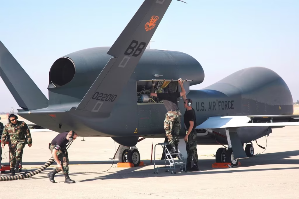
The Northrop Grumman RQ-4 Global Hawk carries the title of the world’s largest UAV with a 

130-foot wingspan that rivals a Boeing 737. Built for long-haul surveillance, it soars above 60,000 feet and stays airborne for over 32 hours, covering up to 12,000 miles in one go. It’s not just big—it’s relentless.

The advanced on-board sensors for imagery intelligence (IMINT), signals intelligence (SIGINT), and moving target indicator (MTI) can scan entire countries, like South Korea, in just one day. But all these capabilities come at a premium price: $82.5 million per unit, making it more expensive than many piloted military aircraft. 

MQ-9 Reaper

MQ-9 Reaper

MQ-9 Reaper is the second-largest military drone. Built by General Atomics, this 66-foot wingspan UAV is the U.S. military’s go-to for intelligence, surveillance, and precision strikes. Powered by a Honeywell turboprop engine, the Reaper can carry over 3,700 pounds of mixed payload, think Hellfire missiles and smart bombs,  while cruising more than 1,000 miles from base.

With a dual-crew team at the helm (pilot and sensor operator), the Reaper offers full-motion video from its Multi-Spectral Targeting System—infrared, shortwave, laser, you name it—all fused into a single tactical view. It loiters for hours, waiting to strike high-value or fast-moving targets at a moment’s notice. Fully satellite-linked and fielded as a complete system, it includes not just the aircraft but a full suite of control stations and support equipment. 

PHASA-35

PHASA-35

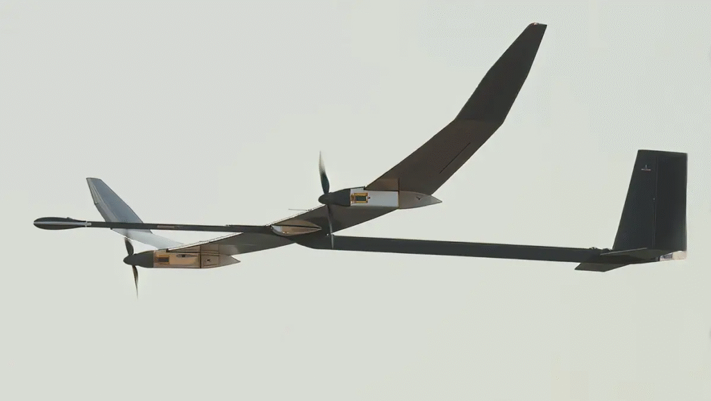
PHASA-35 represents a different category of large drone — one that can cruise in the stratosphere. With a massive 35-meter wingspan and a feather-light weight of just 150 kg (330 pounds), this High Altitude Pseudo Satellite (HAPS) drone floats at over 66,000 feet for months at a time. By day, it soaks up the sun through photovoltaic arrays. By night, it runs on energy stored in onboard fuel cells. 

PHASA-35 is designed to deliver low-cost, ultra-persistent coverage for surveillance, communications, border protection, and even 5G networks, all without the price tag or carbon footprint of traditional satellites. Its modular payload bay also supports next-gen ISR tools and evolving tech, making it a plug-and-play platform for both defense and commercial use. 

Zephyr 

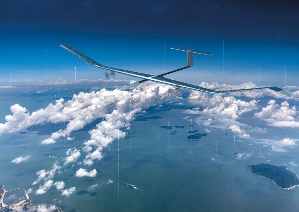
The Airbus Zephyr is a solar-powered stratospheric flyer with satellite ambitions minus the rocket launch. With a 25-meter wingspan and weighing just 65 kg, this ultra-light High Altitude Platform Station (HAPS) climbs to over 60,000 feet in about 10 hours and stays there, cruising far above commercial air traffic. Its solar arrays juice up by day, while next-gen batteries keep it airborne through the night. The current endurance record is 64 days. And with battery advances driven by the EV boom, a 90+ day span is well within reach.

Zephyr’s payload capacity may be just 5 kg, but it punches above its weight in capability, perfect for ISR, environmental monitoring, and future 5G connectivity. It offers persistent, low-cost coverage where satellites can’t go and conventional aircraft won’t last. After two decades of R&D, Zephyr is finally nearing commercial lift-off, ready to rewrite the rulebook on long-duration aerial surveillance and communication.

Ehang  EH216-S

Ehang  EH216-S

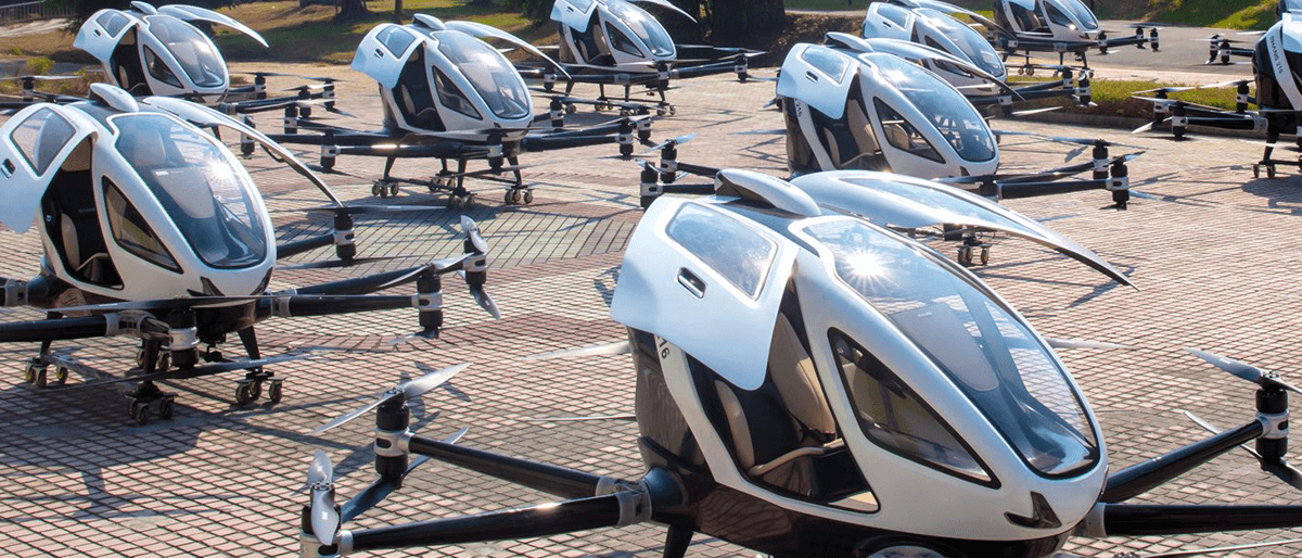
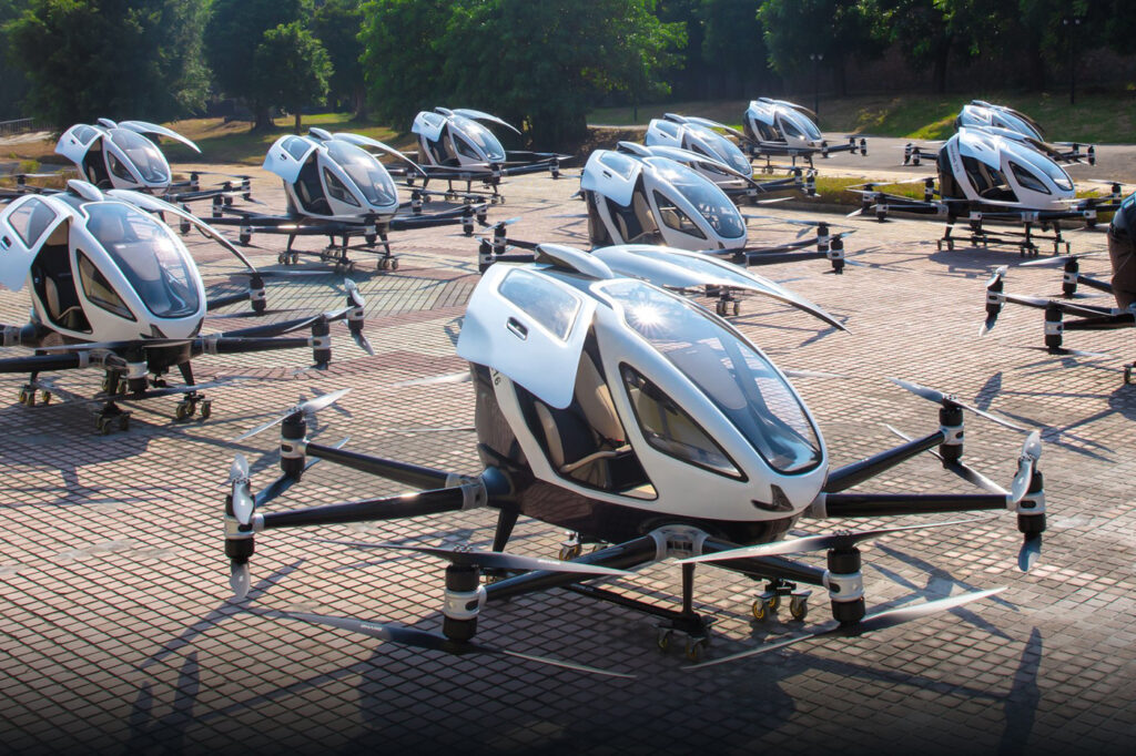
EHang EH216-S is the largest passenger UAV on the market, recently cleared for mass production in China. This sleek VTOL air taxi sports a carbon fiber fuselage, aviation-grade aluminum frame, and 16 coaxial rotors powered by 16 high-efficiency motors. It’s built to carry two passengers at speeds up to 130 km/h for trips up to 30 km—no pilot required.

The brains behind the flight? An automated control system and smart Battery Management System (BMS) that juggles 12 batteries to keep everything running safely, even if one goes down. Lightweight yet tough, the EH216-S combines epoxy composites and sensorless FOC motor control to maximize thrust and minimize heat. With successful manned and unmanned tests under its belt, this 620 kg aerial marvel is ready to revolutionize short-haul urban transport. 

Curious to learn more about different drones? Browse Bavovna’s UAV directory

Who Invented Drones

So, Who Invented Drones?

Drones, aka unmanned aerial vehicles, are often considered a 21st-century gizmo. But they actually go back over a century. So, who invented the first UAV? 

The credit doesn’t go to one single person because the technology advanced in stages, along with wider shifts in scientific knowledge and manufacturing. But one of the pioneers was Archibald Montgomery Low, who developed and flew the first actual remote-controlled unmanned aircraft in 1917. His accomplishments have earned him the title “father of drones”. 

Yet, drone technology also hinges on the advances made by Nikola Tesla, earlier in the 19th century, as well as Peter Cooper, Reginald Denny, and Max Boucher, among others, later in the 20th century. 

The Origins of UAV Technology

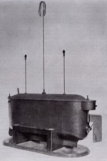
To understand how drones became possible, let’s go back to the late 19th century. It’s the Electrical Exhibition day in Madison Square Garden, New York, and Nikola Tesla is demonstrating his latest research: a radio-controlled boat

While it looked like a present-day toy, the four-foot-long model torpedo boat was a true breakthrough back then. Tesla could wirelessly control the boat’s movement, direction, and lights, using radio waves transmitted from a control box.  Though not an aerial device, Tesla’s invention established fundamental principles of remote control that would later enable modern-day drone technology.

During an anticipatory address, Tesla proposed that the remote control technology would one day render war impossible since even lesser countries would have an effective defense mechanism — a prediction that didn’t quite hold because counter-drone technology developed pretty much at the same pace.  But his ideas, along with Marconi’s invention of the radio transmitter in 1895, indeed were a stepping stone for military UAVs. 

Invention of Military Drones During World War I 

The very first real unmanned aerial vehicles controlled from the ground emerged during World War I. The greatest pioneer in this technology was British engineer Archibald Montgomery Low, who is popularly known as the “father of the drone” or “the father of radio guidance systems”.

In 1916, as an employee of the British military, Low created the Aerial Target, which became the world’s first radio-controlled aircraft. By using compressed air (an innovation in itself!), Low’s team successfully showed remote vehicle control during the short flight of the pioneering aircraft on March 21, 1917. Equipped with a single film camera, Aerial Target was the first drone with a camera. 

During subsequent years, Low continued to tinker with the design and created an electrically powered gyroscope — a key precursor for modern-era internal navigation systems (INS). He also created an early electrically-steered rocket, foreshadowing World War II weaponry. 

Meanwhile, in the US, a father-son Sperry duo and inventor Peter Cooper Hewitt were working on an “Hewitt-Sperry Automatic Airplane” project — an unmanned aircraft for carring explosives. 

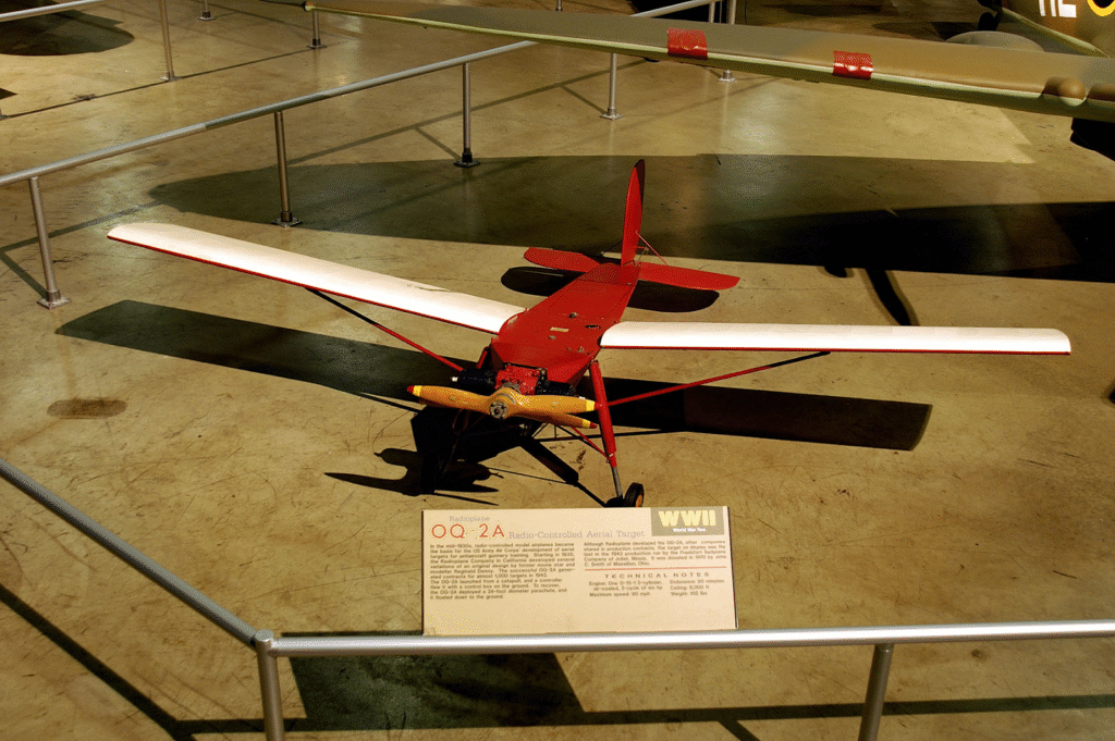
In the 1930s, Reginald Denny, a British actor and aviation enthusiast, took the technology further. He created the first purpose-designed drone, the Radioplane OQ-2, used to train anti-aircraft gunners during the World War II.

Source: National Museum of the United States Air Force 

France’s military pilot Max Boucher also played an important part in the growth of unmanned aviation. His unmanned aircraft, with a wingspan of 15 meters, a length of 10 meters, and a weight of 500 kg, carried out several successful flights, proving the value of autonomous reconnaissance missions.  

Following World War I and II, drone technology for drones improved further. The Radioplane Company started experimenting with the use of mounted pulse jets in place of propellers. The decade witnessed quick technological advancements that would go on to develop present-day military and commercial drones.

The Rise of Compact, Commercial Drones 

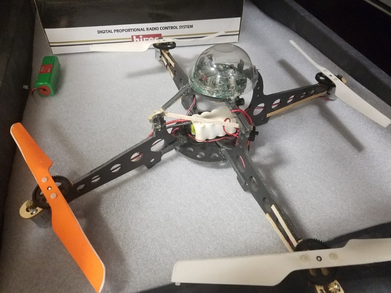
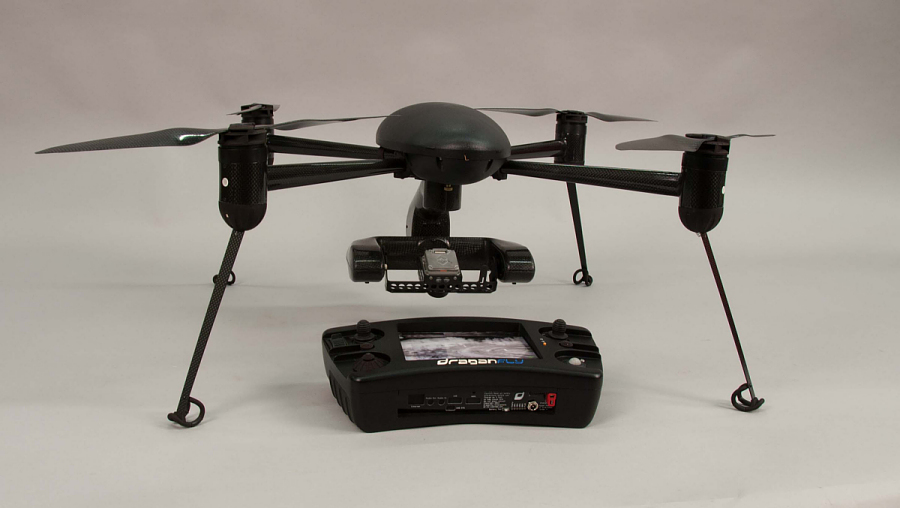
The first hobbyist drones started to crop up during the late 1990s. Canadian Draganfly launched Draganflyer in 1999 — one of the first commercial quadcopters with a camera.

French Parrot was established in 1994 and started capturing market share in the 2010s after releasing the first line-up of smartphone-controlled camera drones. 

DJI, founded in 2006, further popularized the consumer drone segment. Its Phantom lineup, introduced early in the 2010s, married premium-quality cameras and intuitive controls into an affordable, accessible product for hobbyists as well as professional use. 

Today, there are hundreds of drone manufacturers, ranging from large multinational corporations to specialized startups, producing MilTech, industrial inspection, agriculture, and mapping drones. You can learn more about market leaders from our UAV Directory

gps spoofers

TOP 6 Drone GPS Spoofers

UAV navigation hinges on GPS/GNSS signal availability. If the signal’s down, your drone follows the same trajectory. Such scenarios are really easy to orchestrate because drone GPS spoofers can be easily bought online. Our team lined up the best commercial models you can get for security tests, personal safety, or professional operations. 

HackRF One

One of the cheapest drone jamming tools is a software-defined radio (SDR) like HackRF One. Sold freely online for under $300 a pop, the tiny board can hop between read, transmit, and hop between a range of commonly used drone radio frequencies. With the right tweaks and some course code from public repositories, you can fool drones into chasing ghost coordinates or panicking over bogus no-fly zones. But because HackRF One has limited power output, the spoofing range is just under a few hundred meters. 

SZMID UAD-GQ03

Chinese SZMID sells a roster of counter-drone technologies — RF detectors, portable drone jamming guns, and a broad spectrum radio jammer at a price range of $150 to $300. It’s compact UAD-GQ03 supports freely programmable frequency bands (from 20MHz to 6GHz) and can be combined with drone detection and spoofing systems for networked operations. To boot, it comes with open-circuit and short-circuit protection, RF protection, and internal power safeguards against electric tampering, making it rather effective for field operations. 

AL ASAR TECH Portable UAV GPS Spoofer 

Shenzhen-based AL ASAR is another vendor of affordable drone GPS jamming devices. The portable GNSS GALILEO Satellite Navigation Spoof System can cause multi-band interferences within a 500-meter radius, institute no-fly zones, or force emergency landing.  With a weight of under 5 kg and an integrated battery of 10Ah, it’s a sturdy gear you can take into the field. Unlike other popular GPS spoofers, this device can also meddle with GLONASS, BDS, and GALILEO frequencies. 

WRJ-02 Drone Gun

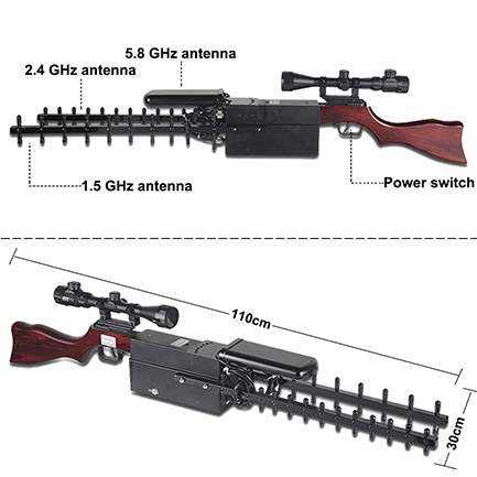
WRJ-02 is a more expensive gear, retailing from $6K. But it also has close to military-grade capabilities (despite being sold freely) — an extended 1.5GHz, 2.4GHz, and 5.8GHz range, 500-1000 meter jamming range, and a unique segmented jamming function. You can either jam the GPS signal to force a return to home. Or fiddle with image transmission or UAV controls to cause equipment loss. If you activate all three modes at the same time, the drone will be forced to land. 

AXPY3000 by AxEnd, Inc.

California-based AxEdn offers one of the best GPS spoofers for drones in terms of coverage. AXPY3000, the flagship device, has a deflection angle of Horizontal 360° Vertical ±90°, an operating range of an impressive 3km, and five-band frequency support (GPS L1/L2, BDS B1/B2, and GLONASS L1. An IP65 protection rating and temperature operating range of 40°C to +65°C make it a super-strurdy and reliable device for repelling drone traffic. 

ND-BG002 GPS Spoofing Jammer

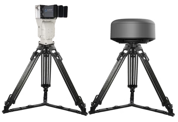
If you have a bigger budget, NovoQuad Group’s ND-BG002 GPS Spoofing device can be a great investment. It’s a newer generation of tools that uses simulated satellite technology to overpower genuine GNSS signals, redirecting drones to predefined coordinates within a 500 to 3 km range. Ethernet interface provides centralized control, allowing real-time coordination with radar and RF detectors for networked threat response.

Best Drone GPS Spoofers Comparison 

ModelOperating RangeFrequencesKey FeaturesPrice 
HackRF One200 mGPS L1 (requires TCXO upgrade for stable spoofing)Open-source SDR, DIY configuration, requires technical expertise$300
SZMID UAD-GQ031,000 m2.4 GHz, 5.8 GHz, GPSPortable design, multi-band jamming, adjustable power$150-$200
AL ASAR TECH Portable UAV GPS Spoofer500 mGPS L1, GLONASS G1, BDS B1, GALILEO E1Suitcase design, directional spoofing, low-power operationOn request
WRJ-02 Drone Gun500-1,000 m1.5 GHz (GPS), 2.4 GHz, 5.8 GHzSegmented jamming, battery-powered, gun-style targeting$6,129
AXPY3000 by AxEnd, Inc.1-30 kmGPS L1/L2/L5, GLONASS L1/L2, BDS B1/B2, GALILEO E1, QZSS L1Military-grade, IP65-rated, radar integration, 360° coverageOn request
ND-BG002 GPS Spoofing Jammer500 m-3 kmGPS, GLONASS, GalileoAdjustable jamming distance (-38 to 32 dBm), centralized controlOn request

Fly UAVs without Disruption with Bavovna 

For every weapon, there’s a counterstrike — and in the drone world, that’s Bavovna’s AI Navigation Kit. 

At Bavovna, we built an AI-powered hybrid INS system designed to outsmart regular GPS spoofers. Housed in a hardened EW case, our kit enables precise navigation in GPS-denied zones, smooth flight through jammed airspace, and fully autonomous operation — no map or signal required.

Learn more about Bavovna’s AI Navigation Kit.

Unmanned and Autonomous Systems Summit

Bavovna AI at the 2025 Unmanned and Autonomous Systems Summit 

We’re excited to announce that Bavovna AI will be featured at the 2025 Unmanned and Autonomous Systems Summit, taking place April 16–17, 2025, at the National Housing Center in Washington, D.C.

Bavovna AI is a dual-use technology company specializing in AI-driven alternative PNT (Positioning, Navigation, and Timing) for unmanned vehicles operating in GNSS-denied and electronic warfare (EW) environments.

Our flagship solution, the UAV AirTower, developed in collaboration with Aurelia Aerospace, delivers unjammable and non-spoofable positioning with 99.98% accuracy—without relying on maps or visual inputs. Using advanced Hybrid Inertial Navigation, AirTower ensures precise and resilient UAV operations across the most challenging terrains, including sand dunes, snow deserts, and maritime domains.

Event: 2025 Unmanned and Autonomous Systems Summit
Date: April 16–17, 2025
Location: National Housing Center, Washington, D.C. 1201 15th St NW, Washington, DC 20005

counter drone

Counter Drone Technology Overview

UAVs aren’t just for shooting cool vacay videos or doing industrial asset inspections. With some tinkering, even a simple starter drone can become a real danger to public safety. In the actual conflict zones, anti-drone systems are saturating strategic locations. 

As the adage goes, awareness is the first line of defense. So, we prepared this quick brief about counter-drone technology. 

Common Types of Counter-Drone Systems

Whether you’re seeking protection or, on the contrary, want to understand the threats looming in contested airspace, here’s an overview of the most common counter-drone technology. 

RF Scanners and Jammers 

Radiofrequency drone scanners tune it to the spectrums, frequently used by most commercial drones to communicate with their controller. An RF scanner can easily detect, identify, and triangulate signals at 4 GHz and 5.8 GHz bands. The cheapest ones cost around $30 on Aliexpress or $80 on eBay. A more expensive $400 hand-held detector, in turn, offers detection capabilities up to a 1 km/0.6 miles range.  

RF Scanners and Jammers

More advanced RF scanners can also decode transmitted metadata like drone model, operator location, or even its unique identifier, enabling drone detection without a line of sight.

Coupled with an RF jammer, this counter-drone technology can effectively take out cruising UAVs using: 

  • Noise jamming: Floods frequencies with random signals to overwhelm the receiver and disrupt the connection link. 
  • Deceptive jamming: Transmits false navigation data to jumble navigation paths or even overtake drone control. 
  • Barrage jamming: Blocks multiple frequencies simultaneously to take down the drone. 

For example, an anti-drone gun from DroneShield creates signal interferences at 433 MHz, 915 MHz, 2.4 GHz, and 5.8 GHz frequencies at a distance of up to 2 km/1.25 miles

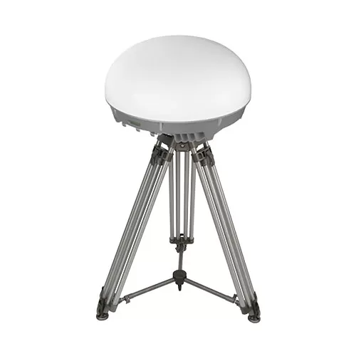
DF-1 (Dome Protection) Electronic Warfare Complex from PIRANHA TECH Ltd offers even better protection with omnidirectional radio jamming in the ranges of 300 to 5900 mHz. Thanks to its compact size, it can be mounted on both buildings and vehicles to safeguard critical assets. 

Generally, RF drone jammers can cause major havoc unless you use counter strategies like frequency-hopping, signal encryption, or fully autonomous drone flight modes. 

Electro-Optical (EO) Systems

EO counter-drone systems combine HD cameras with thermal sensors to detect passing drones — their shape, movement patterns, and contrast against the background. Modern EO sensors have ultra-high sensitivity in the range of 0.001 to 0.01 lux, allowing effective drone detection at night or during low-light conditions. 

Top-of-the-range EO drone detection equipment like Elbit Systems’ ReDrone™ or EOS R500 Remote Weapon System also features integrated computer vision for even sharper detection. 

EOS R500 Remote Weapon System

Once a drone is visually confirmed, the EO system can continuously track it, providing detailed data such as flight path, altitude, and speed. Or it can transmit a signal to a connected RF drone jammer to take it down. 

Acoustic Sensors 

Simpler anti-drone systems use acoustic sensors to detect noise signatures from passing drones, such as propeller whirring and motor humming. Using a library of known drone signatures, the system can then identify specific drone models and estimate their location and direction of movement. 

A standard acoustic drone detection system usually operates in the 20 Hz and 20 kHz range, with most attuned to the 1 kHz to 10 kHz range where drone propeller and motor noise is most audible. Ukrainian military forces, for example, have built a highly effective (and low-cost) acoustic drone detection network around the country, now eyed by the US military. 

For extra precision, some acoustic drone detection systems may also leverage neural networks. Generally, acoustic sensors are deployed as an alternative to RF drone jammers in urban or manufacturing areas, where RF signal noise is high and visual detection is limited.  

Radar Systems 

Counter drone radar systems monitor for drones entering the surveilled perimeter. By analyzing reflected radio waves, an anti-drone radar can estimate the UAV’s position, speed, altitude, and trajectory. And then alert the ground team to take action. 

Unlike optical or acoustic drone detection systems, even the cheapest radars work effectively in all weather conditions and don’t require a direct line of sight, enabling long-range drone detection. More advanced ones, in turn, can even detect smaller, low-flying FPV drones with high accuracy. 

Counter drone radar systems monitor

Again, anyone can purchase drone detection radars online these days on online marketplaces, with the price tag starting at about $7,000 per two sets

GPS Drone Spoofers 

GPS drone spoofers are arguably the most deployed counter-drone technology. Cheap and effective, they swap the legitimate signal for a fake one to send the UAV off course or force it to return to a fake home location.

Technically, GPS spoofers produce GPS L1 or L2 signals (1.57542 GHz and 1.2276 GHz, respectively), using synchronized timing and data structures to imitate satellite constellations. Advanced models may also adjust the timing and Doppler shift of their signals to make the deception more convincing for unsuspecting vehicles. 

GPS Drone Spoofers 

The cheapest GPS spoofers retail for just under $200 online, while military-grade ones go for up to $100K. The latter have a longer range, higher signal precision, and more sophisticated controls. Some models, like the KVERTUS AD G-6 anti-drone gun, also combine GPS and RF jamming to fully disorient the drone. At any rate, your best odds of ‘surviving the encounter’ is to switch to an alternative navigation mode, for example, using data from INS

High-Power Microwave (HPM) Devices  

Moving on to the realm of military-grade anti-drone weapons, we have the new breed of HMP anti-drone systems, actively tested by several governments.  Such devices emit highly concentrated electromagnetic energy bursts (at a 300 MHz and 300 GHz range) to effectively “fry” the drone’s electronics. 

The advantages of HPM systems:

  • No reliance on visual, acoustic, or RF signatures
  • Ultra-fast response even to multiple targets (e.g., in drone swarm attack scenarios) 
  • Non-lethal for operators or invisible bystanders
High-Power Microwave (HPM) Devices  

The obvious downside is the cost. HPMs retail for several million dollars. For example, the four  HPM counter-swarm system prototypes commissioned by the US military cost $66 million. 

Laser Anti-Drone Systems

Laser anti-drone systems are another proven method for destroying hostile UAVs. A focused beam hits the drone’s propellers, sensors, or onboard electronics until they melt, and the drone crashes. 

Most laser drone guns include EO or infrared tracking to lock onto the moving target, maintain focus, and then fire a near-instantaneous laser pulse to take it down. This allows for great accuracy and minimizes collateral damage. On the downside, the system’s effectiveness goes down with atmospheric conditions such as dust, fog, rain, or smoke as these scatter or absorb the beam. 

Cruise Without Disruption with Bavovna’s AI Kit 

Counter-drone technologies like GPS spoofers, RF jammers, and EW drone guns have become really affordable and easy to purchase. But counter techniques evolve, too.

At Bavovna, we’ve developed a hybrid INS system, powered by AI to safely fly in hostile environments. Hosted in a protective EW case, our AI kit enables seamless navigation in GPS-denied environments, safe cruising through jammed areas, and even fully autonomous flights. 

Bavovna’s AI Navigation Kit Specs

Learn more about Bavovna’s AI Navigation Kit.

lidar uav

LiDAR UAV: Is It Worth an Investment?

In 2016, the U.S. Federal Aviation Administration (FAA) authorized using drones weighing 55 pounds or less. LiDAR UAV mapping was one of the first new use cases, used to survey vegetation enrichment across power lines. 

Almost a decade later, LiDAR UAV sensors and payloads are plenty to go around. But are they a good investment? Here’s our take. 

Advantages of a UAV LiDAR Sensor

LiDAR is kind of like echolocation but with light — it measures distance by bouncing laser beams off objects. This capability adds some major improvements to autonomous navigation, obstacle detection, and land surveying. 

Autonomous Navigation in GPS-Denied Environments

UAV LiDAR sensors allow drones to stay on the flight path even when the GPS signal is weak or absent. Thanks to Simultaneous Localization and Mapping (SLAM), drones can be programmed to create a live 3D map of the surroundings to localize itself. For instance, Flyability Elios 3 uses a combination of computer vision, LiDAR payload, and an NVIDIA GPU to instantaneously create a live point cloud for indoor navigation.  

SLAM enables a host of drone use cases in mining — shaft and tunnel exploration, geotechnical stability analysis, and terrain mapping among others. Likewise, it improves indoor drone deployments in large warehouses or storage tanks, where GNSS signal interference is high. 

Real-Time Obstacle Detection and Avoidance

LiDAR lends UAVs extra ‘sensing powers’ for early obstacle detection and avoidance. Modern sensors emit laser pulses in all directions (often with a spinning scanner or multi-beam setup), giving the drone a 360° situational awareness without relying on a pilot camera. 

State-of-the-art LiDAR-based collision avoidance systems can compute avoidance trajectories for drones in just 50 milliseconds. In practice, this means a UAV can traverse complex terrains — busy urban areas, industrial sites, or forests with dense vegetation — even in full auto-pilot mode

Cost-Effective Surveying and Mapping 

Mapping is arguably where LiDAR makes the most difference. Specialized LiDAR payloads measure the ground distance with centimeter-level precision, supplying surveyors with detailed digital terrain models (DTMs) and digital surface models (DSMs). 

Because the best long-range drones can fly relatively low and slow (thanks to a bigger battery), you can collect a high density of points, capturing fine terrain features like narrow power lines or moving animals in less time. Topographic surveys, which used to take weeks with conventional methods, can now be done in a day

Disadvantages of a UAV LiDAR

Adding LiDAR sensors to drones unlocks new enviable capabilities. But just like with any other technology, there are several tradeoffs. 

Higher Power Consumption 

UAV LiDAR sensors are on the bulky side, meaning less stability and reduced flight time.  Flyability Elios 3 drone has a regular flight time of 12 minutes, which drops to just 9 when 

A LiDAR payload is mounted. For VTOLs with bigger batteries, high power consumption is less of a pickle. However, ensuring proper power management for a custom LiDAR payload can require some structural modifications. 

High Price Tag 

Compared to a decade ago, LiDAR UAV technology has become more affordable. Still, the cost of an entry-level drone LiDAR systems start at around $2,000 to $5,000. If you want higher precision systems with embedded quality assurance for commercial or tactical applications, be prepared to spend north of $20K. 

Positioning Accuracy

The accuracy of LiDAR data depends on the drone’s positioning system. Standard GNSS receivers in starter drones offer positional accuracy of about 5-10 meters, which isn’t enough for mapping use cases.  For better results, you’ll need  Differential GNSS systems like RTK or PPK improve positional accuracy to 1-2 centimeters. But this means extra investment and dependency on GPS signal quality. 

Alternatives to LiDAR for Smooth Navigation

If you’re main use case for LiDAR UAV is (semi)autonomous navigation in GPS-denined environments, there’s a great alternative to LiDAR — Bavovna’s AI Navigation Kit.  

Unlike expensive and bulky LiDAR systems, Bavovna’s device is low SWAP. The max current consumption is just 10A, and it’s compatible with a standard +5V power supply. Instead of using LiDAR, Bavovna applies AI fusion to process UAV INS data and supply the drone with situational awareness. Custom-trained on live flight data, our system has an 

end point positioning error of under 0.5% in GPS-denined environments. 

Learn more about Bavovna’s AI Navigation Kit

best starter drone

Best Starter Drones in 2025

Soaring into the air has never been easier (or cheaper), thanks to a growing selection of starter drones on the market. There are starter drones for kids retailing for under $25 and more advanced models for videography, racing, inspections, and FPV flights.

At Bavovna, we spend a lot of time, testing different drone models as we train models for AI navigation. And a good part of our team are also avid drone hobbyists. So if you’re in the market for a new quad, here are recs of the best starter drones. 

Best Starter Drone With Camera: DJI Mini 4 Pro 

DJI Mini 4 Pro starter drone

DJI is almost eponymous with the ‘camera drone’. They’ve got several great beginner drones including NEO, Mavic Mini, and Air 2S. But we prefer DJI Mini 3 because it offers a premium drone photography experience without a premium price. 

Lightweight and portable, DJI Mini 3 can cruise for up to 50 minutes (in good flight conditions and with Intelligent Flight Battery Plus add-on). Otherwise, it’s a good 20 to 30 minutes of flight time — more than enough to capture some scenic shots. Extra features like QuickShots mode can help you snap even more content with its  12MP camera with 4K video capabilities. 

A DJI Mini 3 is the best starter drone because of its robust safety features: Geofencing, infrared collision sensors, a downward vision system, and automatic return-to-home when your battery runs out or your connection lags. Overall, DJI Mini 3 offers an affordable gateway into drone videography, making it easy to capture stunning aerial shots—without the complexity of pro-level models.

Runner Ups:

Best Starter FPV Drone: Eachine Novice VI

Eachine Novice VI Starter Drone

Eachine Novice IV is easy to start using, plus it’s packed with pro features to explore as you advance—so you’ll never hit a ceiling. It comes assembled, bound to the radio controller, and the right video channel matched with your goggles aka ready-to-fly. 

Battery life is commendable: about 20 minutes with a stock battery and 30 minutes with an alternative 4S 18650 3000mah. An integrated 1080p camera captures detailed, crisp shots with a 3-axis gimbal preventing motion blur. Hold and headless modes also make novice FVP flying easier and GPS Rescue helps with faster drone retrievals in case your mission went rogue. 

Runner Ups:

Best Starter Drone for Inspections: Skydio X10

Skydio X10 Starter Drone

Skydio X10 is a compact yet long-range drone with an ample flight time of 40 minutes, thanks to an 8419 mAh lithium-ion polymer battery — more than enough to run inspections around larger industrial sites. 

Featuring a triple sensor array—narrow, telephoto, and radiometric thermal cameras— the drone shoots HD footage even in low-light conditions. A  22 lux flashlight also helps. Plus you can opt for an array with a thermal  FLIR Boson+ sensor, offering sensitivity down to 30 mK and a resolution of 640 x 512 px.  

All of these characteristics make SkydioX10 a stellar choice for condition-based asset monitoring programs. 

Runner Ups:

Best Starter Racing Drone: EMAX Tinyhawk III  

EMAX Tinyhawk III Starter Drone

Retailing for about $260 (with all accessories), EMAX Tinyhawk III is a great entry-level racing drone, packed with some solid features. The pre-installed 1S 450 mAh battery system gives about 4-5 minutes in flight time but can be easily swapped for a more robust option. 

With a durable, but lightweight body and propeller protection, Tinyhawk III can withstand the (inevitable) light collisions and bumpy landings, giving you ample room to practice. An improved control system (an EMAX E8 transmitter) offers faster navigation response during swift maneuvers. 

The integrated RunCam Nano 4 FPV camera offers crisp, real-time footage for immersive flights. The triple-combo of affordability, performance, and user-friendly navigation make  EMAX Tinyhawk III a great option for building up your FVP skills. 

Runner Ups:

Discover even more drone recommendations in Bavovna’s UAV directory

uav parts

Where to Buy UAV Parts? Top Recommendations

Whether you just had an unfortunate ‘incident’ with a tree or want to upgrade a VTOL with a new motor for extra flight time, you gotta know where to source UAV parts. 

There are loads of drone parts suppliers on the market — and even more online resellers. To save you time, we’ve put down the list of sites where we’d shop any day for UAV parts and custom-made components. 

3 Places to Get UAV Parts for Leisure and Starter Drones 

If you need some spares for your beginner drone like an extra battery or new propellers for a racer drone, the following websites offer some good deals. 

Banggood. 

If you’re looking for affordable UAV parts, Banggood is a good place to start. The Chinese e-commerce marketplace pedals a lot of wares from mostly Asian-based sellers. The prices are on the cheaper side, but quality can be hit or miss. So always read the reviews. 

GetFVP 

As it says on the tin, GetFPV sells loads of racing FPV drones, along with popular camera drones from DJI, HOVERAir, and Lumenier. Plus, you can find spare parts for all of these manufacturers and others — electronics, frames, propellers, and extra batteries. The goods ship from the US, so delivery times are fast if you’re in North America. 

QuadPartPiker 

QuadPartPicker is a good option for more prolific builders. It offers a bigger selection of quad parts, including flight controllers, receivers, ESCs, frames, and video transmitters. Their jumbo-sized catalog is nicely organized with extra filters to narrow down your selection by size, power, frequency, or another characteristic. Sold brands include Walksnail, Flywoo, AxisFlying, and Happymodel among others. 

3 Suppliers of UAV Parts for Commercial Drones and VTOLs 

You may find the following companies to be great partners if you are looking to build UAV platforms and VTOLs. 

UAVOS 

UAVOS, operating out of Mountain View, California, has built its reputation as a reliable UAV supplier, trusted by the likes of NASA and GRADEONE. Its autopilot models are particularly worthy of attention. Available for fixed-wing and rotary UAVs with a takeoff range of 15 kg to 4000 kg, the autopilot supports dead-reckoning, GPS-denied navigation, automatic take-off and landing, full payload control, and feedback. 

Apart from autopilots, UAVOS also develops frames, servo drives, engines, and ground control units. You can also request fully custom drone construction services or lease their equipment, instead of buying. 

H3Dynamics 

If you’re in the market for a hydrogen-powered UAV engine, H3 Dynamics offers ultra-light hydrogen fuel cell systems with 250W to 2000W nominal power. Their lightest PEM fuel cell stack weighs only 720 gr (1.6 lbs) — a great option for smaller, tactical UAVs. The system is plug-and-play and includes performance data transmission and software for viewing it.  

For long-duration field missions, the team also offers a mobile automatic refilling trailer for safely producing hydrogen from water. Using onboard technology, you can refill a 9L – 350 bar cylinder in under 2.5 hours or faster (depending on the configuration). The conversion process is fully automatic
with little human supervision required. 

Refitech 

Dutch Refitech has been producing custom composite solutions for construction, defense, and more recently — the drone industry — since 1989. They’re best known for light-weight high-endurance, custom-made composite frames for fixed wings, quadcopters, VTOLs, and gyrocopters. 

The company can produce custom-designed drone bodies, based on your specs or hook you up with a good selection of standard carbon tubes and panels for drone construction. They also offer ready-to-fit (sub)assemblies for those seeking faster time-to-market.

Discover even more drone parts manufacturers in Bavovna’s UAV directory

Confirm that you are not a robot.